Rabka-Zdrój geodata
Rabka-Zdrój (Lesser Poland) is a seat of a third-order administrative division; located in Poland in Europe/Warsaw (GMT+2) time zone. With population of 13,071 people, there are 370 cities with bigger population in this country. Compared to other cities in Poland, 96.4% of cities are located further ↑North; 57.8% of cities are located further ←West and 97.4% of cities have lower elevation than Rabka-Zdrój. Note1


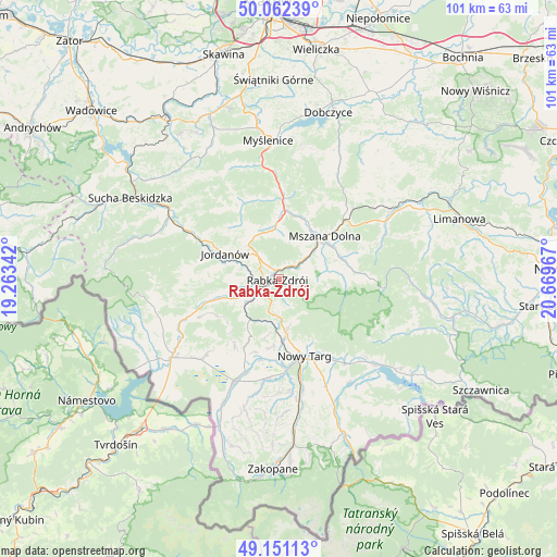
Rabka-Zdrój GPS coordinates[2]
49° 36' 32.004" North, 19° 57' 59.544" East
| Map corner | latitude | longitude |
|---|---|---|
| Upper-left | 50.06239°, | 19.26342° |
| Center: | 49.60889°, | 19.96654° |
| Lower-right: | 49.15113°, | 20.66967° |
| Map W x H: | 101.3×101.3 km | = 62.9×62.9mi |
| max Lat: | 54.83135° ⇑96.4% North |
| Rabka-Zdrój: | 49.60889° |
| min Lat: | ⇓3.6% South 49.21328° |
| min Long | Rabka-Zdrój | max Long |
| 14.20249° | 19.96654° | 24.03723° |
| W 57.8%⇐ | ⇒42.2% E |
Elevation
Elevation of Rabka-Zdrój is 494 m = 1621 ft, and this is 302.6 m = 993 ft above average elevation for this country.
| Max E: |
974 m = 3196 ft | 2.6% |
| Rabka-Zdrój | 494 m 1621 ft | |
| Avg. | 191.4 m = 628 ft | |
Min E: |
-3 m = -10 ft | 97.4% |
See also: Poland elevation on elevation.city.
Geographical zone
Rabka-Zdrój is located in North temperate zone (between Tropic of Cancer and the Arctic Circle). Distance of this North polar circle is 1885.2 km =1171.4 mi to North.| Distance of | km | miles | from Rabka-Zdrój |
|---|---|---|---|
| North Pole | 4491.1 | 2790.6 | to North |
| Arctic Circle | 1885.2 | 1171.4 | to North |
| Tropic Cancer | 2910.1 | 1808.3 | to South |
| Equator | 5516 | 3427.5 | to South |


Nearby cities:
15 places around Rabka-Zdrój: (largest is in red/bold)
• Jordanów
10.8 km =6.7 mi,  294°
294°
• Klikuszowa
10 km =6.2 mi,  172°
172°
• Lasek
11.2 km =7 mi, 174°
• Mszana Dolna
10.9 km =6.8 mi,  48°
48°
• Mszana Górna
11.1 km =6.9 mi,  57°
57°
• Naprawa
7.6 km =4.7 mi,  303°
303°
• Niedźwiedź
8.1 km =5 mi,  80°
80°
• Olszówka
4.5 km =2.8 mi, 82°
• Pyzówka
10.7 km =6.6 mi,  191°
191°
• Raba Wyżna
7.8 km =4.8 mi,  233°
233°
• Rokiciny
5.1 km =3.2 mi,  217°
217°
• Sieniawa
8.2 km =5.1 mi,  198°
198°
• Spytkowice
10.2 km =6.3 mi,  249°
249°
• Toporzysko
12 km =7.5 mi,  278°
278°
• Wysoka
8.6 km =5.3 mi, 277°
Sources, notices
• [Note1] Compared only with cities in Poland existing in our database
• [Src1] Map data: © OpenStreetMap contributors (CC-BY-SA)
• [Src2] Other city data from geonames.org with taken over terms of usage.
• [Src3] Geographical zone / Annual Mean Temperature by Robert A. Rohde @ Wikipedia
