Mieroszów geodata
Mieroszów (Lower Silesia) is a populated place; located in Poland in Europe/Warsaw (GMT+2) time zone. With population of 4,480 people, there are 737 cities with bigger population in this country. Compared to other cities in Poland, 63.5% of cities are located further ↑North; 91.5% of cities are located further →East and 97.3% of cities have lower elevation than Mieroszów. Note1


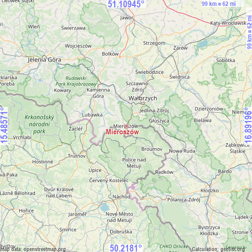
Mieroszów GPS coordinates[2]
50° 39' 57.204" North, 16° 11' 19.788" East
| Map corner | latitude | longitude |
|---|---|---|
| Upper-left | 51.10945°, | 15.48571° |
| Center: | 50.66589°, | 16.18883° |
| Lower-right: | 50.2181°, | 16.89196° |
| Map W x H: | 99.1×99.1 km | = 61.6×61.6mi |
| max Lat: | 54.83135° ⇑63.5% North |
| Mieroszów: | 50.66589° |
| min Lat: | ⇓36.5% South 49.21328° |
| min Long | Mieroszów | max Long |
| 14.20249° | 16.18883° | 24.03723° |
| W 8.5%⇐ | ⇒91.5% E |
Elevation
Elevation of Mieroszów is 489 m = 1604 ft, and this is 297.6 m = 976 ft above average elevation for this country.
| Max E: |
974 m = 3196 ft | 2.7% |
| Mieroszów | 489 m 1604 ft | |
| Avg. | 191.4 m = 628 ft | |
Min E: |
-3 m = -10 ft | 97.3% |
See also: Poland elevation on elevation.city.
Geographical zone
Mieroszów is located in North temperate zone (between Tropic of Cancer and the Arctic Circle). Distance of this North polar circle is 1767.7 km =1098.4 mi to North.| Distance of | km | miles | from Mieroszów |
|---|---|---|---|
| North Pole | 4373.5 | 2717.6 | to North |
| Arctic Circle | 1767.7 | 1098.4 | to North |
| Tropic Cancer | 3027.6 | 1881.3 | to South |
| Equator | 5633.5 | 3500.5 | to South |


Nearby cities:
15 places around Mieroszów: (largest is in red/bold)
• Boguszów-Gorce
10 km =6.2 mi,  6°
6°
• Czarny Bór
12.4 km =7.7 mi,  340°
340°
• Dziećmorowice
16.3 km =10.1 mi,  44°
44°
• Głuszyca
13.1 km =8.1 mi,  79°
79°
• Głuszyca Górna
13.2 km =8.2 mi,  89°
89°
• Jedlina-Zdrój
12.6 km =7.8 mi,  61°
61°
• Kamienna Góra
17.2 km =10.7 mi,  319°
319°
• Krzeszów
11.3 km =7 mi,  312°
312°
• Lubawka
14 km =8.7 mi,  287°
287°
• Ludwikowice Kłodzkie
19.7 km =12.2 mi,  103°
103°
• Stare Bogaczowice
20.2 km =12.6 mi,  0°
0°
• Szczawno-Zdrój
16 km =9.9 mi,  17°
17°
• Walim
18.4 km =11.4 mi, 78°
• Wałbrzych
13.5 km =8.4 mi,  29°
29°
• Włodowice
22.6 km =14 mi,  116°
116°
Sources, notices
• [Note1] Compared only with cities in Poland existing in our database
• [Src1] Map data: © OpenStreetMap contributors (CC-BY-SA)
• [Src2] Other city data from geonames.org with taken over terms of usage.
• [Src3] Geographical zone / Annual Mean Temperature by Robert A. Rohde @ Wikipedia
