Lutomiersk geodata
Lutomiersk (Łódź Voivodeship) is a seat of a third-order administrative division; located in Poland in Europe/Warsaw (GMT+2) time zone. With population of 1,500 people, there are 1837 cities with bigger population in this country. Compared to other cities in Poland, 61.2% of cities are located further ↓South; 55.8% of cities are located further →East and 54.2% of cities have higher elevation than Lutomiersk. Note1
Administrative division(s):
- Level 1: Łódź Voivodeship
- Level 2: Powiat pabianicki
- Level 3: Lutomiersk


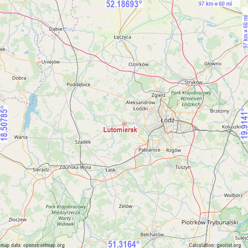
Lutomiersk GPS coordinates[2]
51° 45' 13.536" North, 19° 12' 39.492" East
| Map corner | latitude | longitude |
|---|---|---|
| Upper-left | 52.18693°, | 18.50785° |
| Center: | 51.75376°, | 19.21097° |
| Lower-right: | 51.3164°, | 19.9141° |
| Map W x H: | 96.8×96.8 km | = 60.1×60.1mi |
| max Lat: | 54.83135° ⇑38.8% North |
| Lutomiersk: | 51.75376° |
| min Lat: | ⇓61.2% South 49.21328° |
| min Long | Lutomiersk | max Long |
| 14.20249° | 19.21097° | 24.03723° |
| W 44.2%⇐ | ⇒55.8% E |
Elevation
Elevation of Lutomiersk is 161 m = 528 ft, and this is 30.4 m = 100 ft below average elevation for this country.
| Max E: |
974 m = 3196 ft | 54.2% |
| Avg. | 191.4 m = 628 ft | |
| Lutomiersk | 161 m = 528 ft | |
Min E: |
-3 m = -10 ft | 45.8% |
See also: Poland elevation on elevation.city.
Geographical zone
Lutomiersk is located in North temperate zone (between Tropic of Cancer and the Arctic Circle). Distance of this North polar circle is 1646.7 km =1023.2 mi to North.| Distance of | km | miles | from Lutomiersk |
|---|---|---|---|
| North Pole | 4252.6 | 2642.4 | to North |
| Arctic Circle | 1646.7 | 1023.2 | to North |
| Tropic Cancer | 3148.6 | 1956.4 | to South |
| Equator | 5754.5 | 3575.7 | to South |


Nearby cities:
15 places around Lutomiersk: (largest is in red/bold)
• Aleksandrów Łódzki
9.7 km =6 mi,  41°
41°
• Dalików
15.9 km =9.9 mi,  336°
336°
• Dobroń
13 km =8.1 mi,  169°
169°
• Kazimierz
1.6 km =1 mi,  349°
349°
• Konstantynów Łódzki
7.9 km =4.9 mi,  94°
94°
• Ksawerów
15.4 km =9.6 mi,  120°
120°
• Pabianice
14 km =8.7 mi,  135°
135°
• Parzęczew
21.7 km =13.5 mi,  359°
359°
• Rzgów
21.8 km =13.5 mi, 117°
• Starowa Góra
20 km =12.4 mi,  110°
110°
• Szadek
17.6 km =10.9 mi,  246°
246°
• Wodzierady
5.7 km =3.5 mi,  226°
226°
• Zgierz
17.6 km =10.9 mi,  49°
49°
• Łask
18.9 km =11.7 mi,  196°
196°
• Łódź
18.2 km =11.3 mi,  84°
84°
Sources, notices
• [Note1] Compared only with cities in Poland existing in our database
• [Src1] Map data: © OpenStreetMap contributors (CC-BY-SA)
• [Src2] Other city data from geonames.org with taken over terms of usage.
• [Src3] Geographical zone / Annual Mean Temperature by Robert A. Rohde @ Wikipedia
