Zgierz geodata
Zgierz (Łódź Voivodeship) is a seat of a second-order administrative division; located in Poland in Europe/Warsaw (GMT+2) time zone. With population of 58,036 people, there are 90 cities with bigger population in this country. Compared to other cities in Poland, 62.8% of cities are located further ↓South; 52.5% of cities are located further →East and 55.6% of cities have lower elevation than Zgierz. Note1


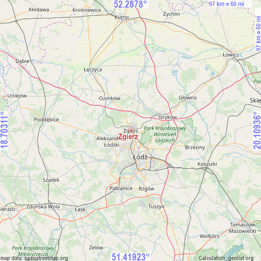
Zgierz GPS coordinates[2]
51° 51' 20.196" North, 19° 24' 22.428" East
| Map corner | latitude | longitude |
|---|---|---|
| Upper-left | 52.2878°, | 18.70311° |
| Center: | 51.85561°, | 19.40623° |
| Lower-right: | 51.41923°, | 20.10936° |
| Map W x H: | 96.6×96.6 km | = 60×60mi |
| max Lat: | 54.83135° ⇑37.2% North |
| Zgierz: | 51.85561° |
| min Lat: | ⇓62.8% South 49.21328° |
| min Long | Zgierz | max Long |
| 14.20249° | 19.40623° | 24.03723° |
| W 47.5%⇐ | ⇒52.5% E |
Elevation
Elevation of Zgierz is 187 m = 614 ft, and this is 4.4 m = 14 ft below average elevation for this country.
| Max E: |
974 m = 3196 ft | 44.4% |
| Avg. | 191.4 m = 628 ft | |
| Zgierz | 187 m = 614 ft | |
Min E: |
-3 m = -10 ft | 55.6% |
See also: Zgierz elevation on elevation.city.
Geographical zone
Zgierz is located in North temperate zone (between Tropic of Cancer and the Arctic Circle). Distance of this North polar circle is 1635.4 km =1016.2 mi to North.| Distance of | km | miles | from Zgierz |
|---|---|---|---|
| North Pole | 4241.3 | 2635.4 | to North |
| Arctic Circle | 1635.4 | 1016.2 | to North |
| Tropic Cancer | 3159.9 | 1963.5 | to South |
| Equator | 5765.8 | 3582.7 | to South |


Nearby cities:
15 places around Zgierz: (largest is in red/bold)
• Aleksandrów Łódzki
8.1 km =5 mi,  240°
240°
• Andrespol
21.5 km =13.4 mi,  131°
131°
• Dalików
20 km =12.4 mi,  279°
279°
• Dobra
10.8 km =6.7 mi,  81°
81°
• Kazimierz
16.8 km =10.4 mi,  234°
234°
• Konstantynów Łódzki
13.2 km =8.2 mi,  204°
204°
• Ksawerów
19.2 km =11.9 mi,  180°
180°
• Lutomiersk
17.6 km =10.9 mi, 229°
• Ozorków
14.3 km =8.9 mi,  326°
326°
• Pabianice
21.5 km =13.4 mi,  189°
189°
• Parzęczew
17.2 km =10.7 mi,  306°
306°
• Starowa Góra
19 km =11.8 mi,  163°
163°
• Stryków
14.6 km =9.1 mi,  69°
69°
• Szczawin
7.5 km =4.7 mi,  48°
48°
• Łódź
10.5 km =6.5 mi,  153°
153°
Sources, notices
• [Note1] Compared only with cities in Poland existing in our database
• [Src1] Map data: © OpenStreetMap contributors (CC-BY-SA)
• [Src2] Other city data from geonames.org with taken over terms of usage.
• [Src3] Geographical zone / Annual Mean Temperature by Robert A. Rohde @ Wikipedia
