Kruszwica geodata
Kruszwica (Kujawsko-Pomorskie) is a seat of a third-order administrative division; located in Poland in Europe/Warsaw (GMT+2) time zone. With population of 9,494 people, there are 460 cities with bigger population in this country. Compared to other cities in Poland, 79% of cities are located further ↓South; 70.8% of cities are located further →East and 87.5% of cities have higher elevation than Kruszwica. Note1
Administrative division(s):
- Level 1: Kujawsko-Pomorskie
- Level 2: Powiat inowrocławski
- Level 3: Kruszwica


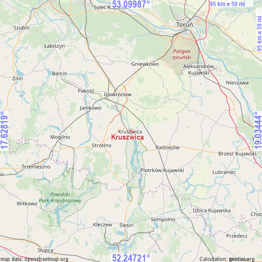
Kruszwica GPS coordinates[2]
52° 40' 32.232" North, 18° 19' 52.716" East
| Map corner | latitude | longitude |
|---|---|---|
| Upper-left | 53.09987°, | 17.62819° |
| Center: | 52.67562°, | 18.33131° |
| Lower-right: | 52.24721°, | 19.03444° |
| Map W x H: | 94.8×94.8 km | = 58.9×58.9mi |
| max Lat: | 54.83135° ⇑21% North |
| Kruszwica: | 52.67562° |
| min Lat: | ⇓79% South 49.21328° |
| min Long | Kruszwica | max Long |
| 14.20249° | 18.33131° | 24.03723° |
| W 29.2%⇐ | ⇒70.8% E |
Elevation
Elevation of Kruszwica is 83 m = 272 ft, and this is 108.4 m = 356 ft below average elevation for this country.
| Max E: |
974 m = 3196 ft | 87.5% |
| Avg. | 191.4 m = 628 ft | |
| Kruszwica | 83 m = 272 ft | |
Min E: |
-3 m = -10 ft | 12.5% |
See also: Poland elevation on elevation.city.
Geographical zone
Kruszwica is located in North temperate zone (between Tropic of Cancer and the Arctic Circle). Distance of this North polar circle is 1544.2 km =959.5 mi to North.| Distance of | km | miles | from Kruszwica |
|---|---|---|---|
| North Pole | 4150.1 | 2578.8 | to North |
| Arctic Circle | 1544.2 | 959.5 | to North |
| Tropic Cancer | 3251.1 | 2020.1 | to South |
| Equator | 5857 | 3639.4 | to South |


Nearby cities:
15 places around Kruszwica: (largest is in red/bold)
• Bytoń
22.1 km =13.7 mi,  126°
126°
• Dobre
16.6 km =10.3 mi,  86°
86°
• Dąbrowa Biskupia
18.3 km =11.4 mi,  51°
51°
• Inowrocław
14.4 km =8.9 mi,  341°
341°
• Janikowo
17 km =10.6 mi,  300°
300°
• Jeziora Wielkie
16.7 km =10.4 mi,  194°
194°
• Kościelec
17.5 km =10.9 mi,  318°
318°
• Pakość
21.7 km =13.5 mi,  310°
310°
• Piotrków Kujawski
17.9 km =11.1 mi,  140°
140°
• Radziejów
14.4 km =8.9 mi,  113°
113°
• Skulsk
21.5 km =13.4 mi,  180°
180°
• Strzelno
12 km =7.5 mi,  243°
243°
• Wierzchosławice
21.6 km =13.4 mi,  4°
4°
• Wilczyn
23.8 km =14.8 mi,  208°
208°
• Zakrzewo
22.3 km =13.9 mi,  65°
65°
Sources, notices
• [Note1] Compared only with cities in Poland existing in our database
• [Src1] Map data: © OpenStreetMap contributors (CC-BY-SA)
• [Src2] Other city data from geonames.org with taken over terms of usage.
• [Src3] Geographical zone / Annual Mean Temperature by Robert A. Rohde @ Wikipedia
