Huta Stara B geodata
Huta Stara B (Silesia) is a section of populated place; located in Poland in Europe/Warsaw (GMT+2) time zone. With population of 1,939 people, there are 1527 cities with bigger population in this country. Compared to other cities in Poland, 61.8% of cities are located further ↑North; 57.5% of cities are located further →East and 85.1% of cities have lower elevation than Huta Stara B. Note1


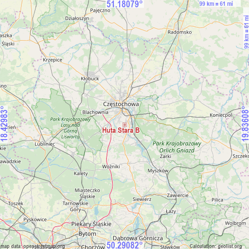
Huta Stara B GPS coordinates[2]
50° 44' 16.512" North, 19° 7' 58.62" East
| Map corner | latitude | longitude |
|---|---|---|
| Upper-left | 51.18079°, | 18.42983° |
| Center: | 50.73792°, | 19.13295° |
| Lower-right: | 50.29082°, | 19.83608° |
| Map W x H: | 99×99 km | = 61.5×61.5mi |
| max Lat: | 54.83135° ⇑61.8% North |
| Huta Stara B: | 50.73792° |
| min Lat: | ⇓38.2% South 49.21328° |
| min Long | Huta Stara B | max Long |
| 14.20249° | 19.13295° | 24.03723° |
| W 42.5%⇐ | ⇒57.5% E |
Elevation
Elevation of Huta Stara B is 290 m = 951 ft, and this is 98.6 m = 323 ft above average elevation for this country.
| Max E: |
974 m = 3196 ft | 14.9% |
| Huta Stara B | 290 m 951 ft | |
| Avg. | 191.4 m = 628 ft | |
Min E: |
-3 m = -10 ft | 85.1% |
See also: Poland elevation on elevation.city.
Geographical zone
Huta Stara B is located in North temperate zone (between Tropic of Cancer and the Arctic Circle). Distance of this North polar circle is 1759.6 km =1093.4 mi to North.| Distance of | km | miles | from Huta Stara B |
|---|---|---|---|
| North Pole | 4365.5 | 2712.6 | to North |
| Arctic Circle | 1759.6 | 1093.4 | to North |
| Tropic Cancer | 3035.6 | 1886.2 | to South |
| Equator | 5641.5 | 3505.5 | to South |


Nearby cities:
15 places around Huta Stara B: (largest is in red/bold)
• Blachownia
12.8 km =8 mi,  291°
291°
• Choroń
10.9 km =6.8 mi,  124°
124°
• Częstochowa
6.5 km =4 mi,  354°
354°
• Jastrząb
8.3 km =5.2 mi,  155°
155°
• Kamienica
15 km =9.3 mi,  220°
220°
• Kamienica Polska
7.5 km =4.7 mi,  185°
185°
• Konopiska
8.9 km =5.5 mi,  262°
262°
• Mstów
14.8 km =9.2 mi,  46°
46°
• Olsztyn
9.6 km =6 mi,  80°
80°
• Poczesna
2.6 km =1.6 mi,  179°
179°
• Poraj
8.8 km =5.5 mi,  139°
139°
• Rudnik Wielki
8.9 km =5.5 mi,  201°
201°
• Rędziny
14.7 km =9.1 mi,  23°
23°
• Siedlec Duży
12 km =7.5 mi, 180°
• Starcza
10.4 km =6.5 mi, 218°
Sources, notices
• [Note1] Compared only with cities in Poland existing in our database
• [Src1] Map data: © OpenStreetMap contributors (CC-BY-SA)
• [Src2] Other city data from geonames.org with taken over terms of usage.
• [Src3] Geographical zone / Annual Mean Temperature by Robert A. Rohde @ Wikipedia
