Długomiłowice geodata
Długomiłowice (Opole Voivodeship) is a populated place; located in Poland in Europe/Warsaw (GMT+2) time zone. With population of 1,600 people, there are 1751 cities with bigger population in this country. Compared to other cities in Poland, 72.5% of cities are located further ↑North; 73.5% of cities are located further →East and 55% of cities have lower elevation than Długomiłowice. Note1
Administrative division(s):
- Level 1: Opole Voivodeship
- Level 2: Powiat kędzierzyńsko-kozielski
- Level 3: Reńska Wieś


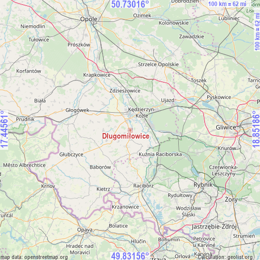
Długomiłowice GPS coordinates[2]
50° 16' 58.728" North, 18° 8' 55.428" East
| Map corner | latitude | longitude |
|---|---|---|
| Upper-left | 50.73016°, | 17.44561° |
| Center: | 50.28298°, | 18.14873° |
| Lower-right: | 49.83156°, | 18.85186° |
| Map W x H: | 99.9×99.9 km | = 62.1×62.1mi |
| max Lat: | 54.83135° ⇑72.5% North |
| Długomiłowice: | 50.28298° |
| min Lat: | ⇓27.5% South 49.21328° |
| min Long | Długomiłowice | max Long |
| 14.20249° | 18.14873° | 24.03723° |
| W 26.5%⇐ | ⇒73.5% E |
Elevation
Elevation of Długomiłowice is 185 m = 607 ft, and this is 6.4 m = 21 ft below average elevation for this country.
| Max E: |
974 m = 3196 ft | 45% |
| Avg. | 191.4 m = 628 ft | |
| Długomiłowice | 185 m = 607 ft | |
Min E: |
-3 m = -10 ft | 55% |
See also: Poland elevation on elevation.city.
Geographical zone
Długomiłowice is located in North temperate zone (between Tropic of Cancer and the Arctic Circle). Distance of this North polar circle is 1810.2 km =1124.8 mi to North.| Distance of | km | miles | from Długomiłowice |
|---|---|---|---|
| North Pole | 4416.1 | 2744 | to North |
| Arctic Circle | 1810.2 | 1124.8 | to North |
| Tropic Cancer | 2985 | 1854.8 | to South |
| Equator | 5590.9 | 3474 | to South |


Nearby cities:
15 places around Długomiłowice: (largest is in red/bold)
• Bierawa
6.6 km =4.1 mi,  91°
91°
• Cisek
3.6 km =2.2 mi, 91°
• Dziergowice
10.8 km =6.7 mi,  114°
114°
• Januszkowice
12.1 km =7.5 mi,  356°
356°
• Komorno
9.8 km =6.1 mi,  327°
327°
• Koźle
5.9 km =3.7 mi, 356°
• Kędzierzyn-Koźle
9.2 km =5.7 mi,  36°
36°
• Lubieszów
8.7 km =5.4 mi, 106°
• Ostrożnica
6.4 km =4 mi,  226°
226°
• Pawłowiczki
8.2 km =5.1 mi,  240°
240°
• Poborszów
11.2 km =7 mi,  335°
335°
• Pokrzywnica
8.3 km =5.2 mi,  311°
311°
• Polska Cerekiew
6.3 km =3.9 mi,  194°
194°
• Reńska Wieś
4 km =2.5 mi, 336°
• Większyce
6.8 km =4.2 mi, 331°
Sources, notices
• [Note1] Compared only with cities in Poland existing in our database
• [Src1] Map data: © OpenStreetMap contributors (CC-BY-SA)
• [Src2] Other city data from geonames.org with taken over terms of usage.
• [Src3] Geographical zone / Annual Mean Temperature by Robert A. Rohde @ Wikipedia
