Polska Cerekiew geodata
Polska Cerekiew (Opole Voivodeship) is a seat of a third-order administrative division; located in Poland in Europe/Warsaw (GMT+2) time zone. With population of 1,429 people, there are 1927 cities with bigger population in this country. Compared to other cities in Poland, 73.9% of cities are located further ↑North; 73.7% of cities are located further →East and 59.4% of cities have lower elevation than Polska Cerekiew. Note1
Administrative division(s):
- Level 1: Opole Voivodeship
- Level 2: Powiat kędzierzyńsko-kozielski
- Level 3: Polska Cerekiew


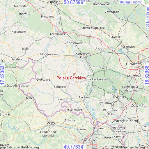
Polska Cerekiew GPS coordinates[2]
50° 13' 41.772" North, 18° 7' 36.3" East
| Map corner | latitude | longitude |
|---|---|---|
| Upper-left | 50.67596°, | 17.42363° |
| Center: | 50.22827°, | 18.12675° |
| Lower-right: | 49.77634°, | 18.82988° |
| Map W x H: | 100×100 km | = 62.1×62.1mi |
| max Lat: | 54.83135° ⇑73.9% North |
| Polska Cerekiew: | 50.22827° |
| min Lat: | ⇓26.1% South 49.21328° |
| min Long | Polska Cerekiew | max Long |
| 14.20249° | 18.12675° | 24.03723° |
| W 26.3%⇐ | ⇒73.7% E |
Elevation
Elevation of Polska Cerekiew is 199 m = 653 ft, and this is 7.6 m = 25 ft above average elevation for this country.
| Max E: |
974 m = 3196 ft | 40.6% |
| Polska Cerekiew | 199 m 653 ft | |
| Avg. | 191.4 m = 628 ft | |
Min E: |
-3 m = -10 ft | 59.4% |
See also: Poland elevation on elevation.city.
Geographical zone
Polska Cerekiew is located in North temperate zone (between Tropic of Cancer and the Arctic Circle). Distance of this North polar circle is 1816.3 km =1128.6 mi to North.| Distance of | km | miles | from Polska Cerekiew |
|---|---|---|---|
| North Pole | 4422.2 | 2747.8 | to North |
| Arctic Circle | 1816.3 | 1128.6 | to North |
| Tropic Cancer | 2978.9 | 1851 | to South |
| Equator | 5584.9 | 3470.3 | to South |


Nearby cities:
15 places around Polska Cerekiew: (largest is in red/bold)
• Bierawa
10.1 km =6.3 mi,  54°
54°
• Brzeźnica
11.2 km =7 mi,  142°
142°
• Budziska
11.1 km =6.9 mi,  104°
104°
• Cisek
7.9 km =4.9 mi,  40°
40°
• Dziergowice
11.4 km =7.1 mi,  82°
82°
• Długomiłowice
6.3 km =3.9 mi,  14°
14°
• Koźle
12 km =7.5 mi, 5°
• Lubieszów
10.5 km =6.5 mi,  70°
70°
• Ostrożnica
3.6 km =2.2 mi,  298°
298°
• Pawłowiczki
5.9 km =3.7 mi,  290°
290°
• Pokrzywnica
12.5 km =7.8 mi,  338°
338°
• Reńska Wieś
9.7 km =6 mi,  359°
359°
• Rudnik
12 km =7.5 mi,  159°
159°
• Turze
10.6 km =6.6 mi,  111°
111°
• Większyce
12.2 km =7.6 mi,  351°
351°
Sources, notices
• [Note1] Compared only with cities in Poland existing in our database
• [Src1] Map data: © OpenStreetMap contributors (CC-BY-SA)
• [Src2] Other city data from geonames.org with taken over terms of usage.
• [Src3] Geographical zone / Annual Mean Temperature by Robert A. Rohde @ Wikipedia
