Większyce geodata
Większyce (Opole Voivodeship) is a populated place; located in Poland in Europe/Warsaw (GMT+2) time zone. With population of 1,055 people, there are 2399 cities with bigger population in this country. Compared to other cities in Poland, 71.1% of cities are located further ↑North; 74.1% of cities are located further →East and 56.5% of cities have lower elevation than Większyce. Note1
Administrative division(s):
- Level 1: Opole Voivodeship
- Level 2: Powiat kędzierzyńsko-kozielski
- Level 3: Reńska Wieś


Większyce GPS coordinates[2]
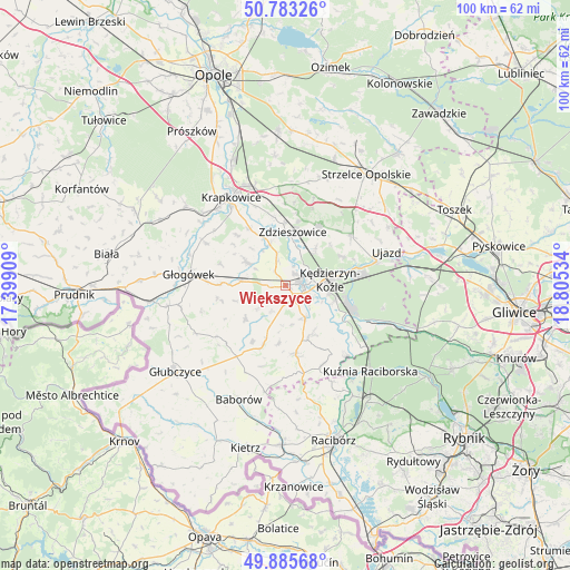
50° 20' 11.724" North, 18° 6' 7.956" East
| Map corner | latitude | longitude |
|---|---|---|
| Upper-left | 50.78326°, | 17.39909° |
| Center: | 50.33659°, | 18.10221° |
| Lower-right: | 49.88568°, | 18.80534° |
| Map W x H: | 99.8×99.8 km | = 62×62mi |
| max Lat: | 54.83135° ⇑71.1% North |
| Większyce: | 50.33659° |
| min Lat: | ⇓28.9% South 49.21328° |
| min Long | Większyce | max Long |
| 14.20249° | 18.10221° | 24.03723° |
| W 25.9%⇐ | ⇒74.1% E |
Elevation
Elevation of Większyce is 189 m = 620 ft, and this is 2.4 m = 8 ft below average elevation for this country.
| Max E: |
974 m = 3196 ft | 43.5% |
| Avg. | 191.4 m = 628 ft | |
| Większyce | 189 m = 620 ft | |
Min E: |
-3 m = -10 ft | 56.5% |
See also: Poland elevation on elevation.city.
Geographical zone
Większyce is located in North temperate zone (between Tropic of Cancer and the Arctic Circle). Distance of this North polar circle is 1804.3 km =1121.1 mi to North.| Distance of | km | miles | from Większyce |
|---|---|---|---|
| North Pole | 4410.2 | 2740.4 | to North |
| Arctic Circle | 1804.3 | 1121.1 | to North |
| Tropic Cancer | 2991 | 1858.5 | to South |
| Equator | 5596.9 | 3477.8 | to South |


Nearby cities:
15 places around Większyce: (largest is in red/bold)
• Cisek
9.2 km =5.7 mi,  131°
131°
• Dobieszowice
6.1 km =3.8 mi,  298°
298°
• Długomiłowice
6.8 km =4.2 mi,  151°
151°
• Januszkowice
6.6 km =4.1 mi,  21°
21°
• Komorno
3 km =1.9 mi,  319°
319°
• Koźle
2.9 km =1.8 mi,  92°
92°
• Kędzierzyn-Koźle
8.9 km =5.5 mi,  80°
80°
• Ostrożnica
10.4 km =6.5 mi,  187°
187°
• Poborszów
4.5 km =2.8 mi,  342°
342°
• Pokrzywnica
2.9 km =1.8 mi,  261°
261°
• Raszowa
8.6 km =5.3 mi,  38°
38°
• Reńska Wieś
2.9 km =1.8 mi,  143°
143°
• Twardawa
7.9 km =4.9 mi,  275°
275°
• Walce
8.1 km =5 mi, 300°
• Zdzieszowice
9.9 km =6.2 mi,  8°
8°
Sources, notices
• [Note1] Compared only with cities in Poland existing in our database
• [Src1] Map data: © OpenStreetMap contributors (CC-BY-SA)
• [Src2] Other city data from geonames.org with taken over terms of usage.
• [Src3] Geographical zone / Annual Mean Temperature by Robert A. Rohde @ Wikipedia
