Reńska Wieś geodata
Reńska Wieś (Opole Voivodeship) is a seat of a third-order administrative division; located in Poland in Europe/Warsaw (GMT+2) time zone. With population of 1,800 people, there are 1605 cities with bigger population in this country. Compared to other cities in Poland, 71.6% of cities are located further ↑North; 73.8% of cities are located further →East and 53.5% of cities have lower elevation than Reńska Wieś. Note1
Administrative division(s):
- Level 1: Opole Voivodeship
- Level 2: Powiat kędzierzyńsko-kozielski
- Level 3: Reńska Wieś


Reńska Wieś GPS coordinates[2]
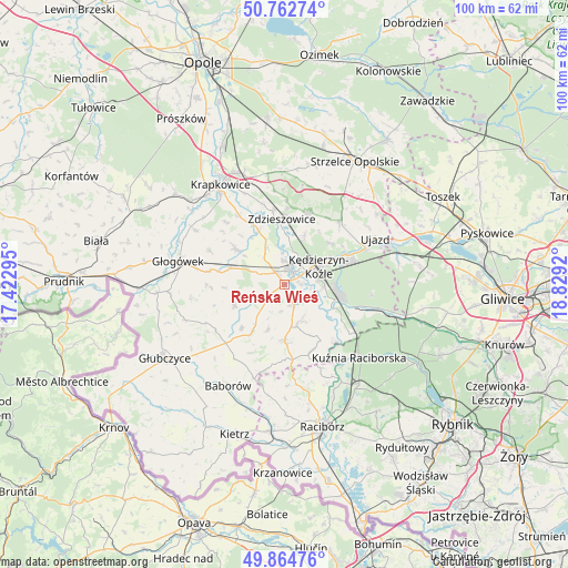
50° 18' 57.132" North, 18° 7' 33.852" East
| Map corner | latitude | longitude |
|---|---|---|
| Upper-left | 50.76274°, | 17.42295° |
| Center: | 50.31587°, | 18.12607° |
| Lower-right: | 49.86476°, | 18.8292° |
| Map W x H: | 99.8×99.8 km | = 62×62mi |
| max Lat: | 54.83135° ⇑71.6% North |
| Reńska Wieś: | 50.31587° |
| min Lat: | ⇓28.4% South 49.21328° |
| min Long | Reńska Wieś | max Long |
| 14.20249° | 18.12607° | 24.03723° |
| W 26.2%⇐ | ⇒73.8% E |
Elevation
Elevation of Reńska Wieś is 181 m = 594 ft, and this is 10.4 m = 34 ft below average elevation for this country.
| Max E: |
974 m = 3196 ft | 46.5% |
| Avg. | 191.4 m = 628 ft | |
| Reńska Wieś | 181 m = 594 ft | |
Min E: |
-3 m = -10 ft | 53.5% |
See also: Poland elevation on elevation.city.
Geographical zone
Reńska Wieś is located in North temperate zone (between Tropic of Cancer and the Arctic Circle). Distance of this North polar circle is 1806.6 km =1122.6 mi to North.| Distance of | km | miles | from Reńska Wieś |
|---|---|---|---|
| North Pole | 4412.5 | 2741.8 | to North |
| Arctic Circle | 1806.6 | 1122.6 | to North |
| Tropic Cancer | 2988.7 | 1857.1 | to South |
| Equator | 5594.6 | 3476.3 | to South |


Nearby cities:
15 places around Reńska Wieś: (largest is in red/bold)
• Bierawa
9.1 km =5.7 mi,  115°
115°
• Cisek
6.4 km =4 mi,  125°
125°
• Dobieszowice
8.8 km =5.5 mi,  306°
306°
• Długomiłowice
4 km =2.5 mi,  156°
156°
• Januszkowice
8.5 km =5.3 mi,  5°
5°
• Komorno
5.9 km =3.7 mi,  321°
321°
• Koźle
2.5 km =1.6 mi,  29°
29°
• Kędzierzyn-Koźle
8 km =5 mi,  61°
61°
• Ostrożnica
8.6 km =5.3 mi,  200°
200°
• Pawłowiczki
9.5 km =5.9 mi,  215°
215°
• Poborszów
7.2 km =4.5 mi,  335°
335°
• Pokrzywnica
4.9 km =3 mi,  292°
292°
• Polska Cerekiew
9.7 km =6 mi,  179°
179°
• Raszowa
9.8 km =6.1 mi,  21°
21°
• Większyce
2.9 km =1.8 mi, 323°
Sources, notices
• [Note1] Compared only with cities in Poland existing in our database
• [Src1] Map data: © OpenStreetMap contributors (CC-BY-SA)
• [Src2] Other city data from geonames.org with taken over terms of usage.
• [Src3] Geographical zone / Annual Mean Temperature by Robert A. Rohde @ Wikipedia
