Bierutów geodata
Bierutów (Lower Silesia) is a seat of a third-order administrative division; located in Poland in Europe/Warsaw (GMT+2) time zone. With population of 5,065 people, there are 682 cities with bigger population in this country. Compared to other cities in Poland, 51.7% of cities are located further ↑North; 79.5% of cities are located further →East and 60.3% of cities have higher elevation than Bierutów. Note1


Bierutów GPS coordinates[2]
51° 7' 27.948" North, 17° 32' 45.852" East
| Map corner | latitude | longitude |
|---|---|---|
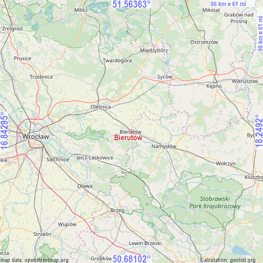
| Upper-left | 51.56363°, | 16.84295° |
| Center: | 51.12443°, | 17.54607° |
| Lower-right: | 50.68102°, | 18.2492° |
| Map W x H: | 98.1×98.1 km | = 61×61mi |
| max Lat: | 54.83135° ⇑51.7% North |
| Bierutów: | 51.12443° |
| min Lat: | ⇓48.3% South 49.21328° |
| min Long | Bierutów | max Long |
| 14.20249° | 17.54607° | 24.03723° |
| W 20.5%⇐ | ⇒79.5% E |
Elevation
Elevation of Bierutów is 146 m = 479 ft, and this is 45.4 m = 149 ft below average elevation for this country.
| Max E: |
974 m = 3196 ft | 60.3% |
| Avg. | 191.4 m = 628 ft | |
| Bierutów | 146 m = 479 ft | |
Min E: |
-3 m = -10 ft | 39.7% |
See also: Poland elevation on elevation.city.
Geographical zone
Bierutów is located in North temperate zone (between Tropic of Cancer and the Arctic Circle). Distance of this North polar circle is 1716.7 km =1066.7 mi to North.| Distance of | km | miles | from Bierutów |
|---|---|---|---|
| North Pole | 4322.6 | 2685.9 | to North |
| Arctic Circle | 1716.7 | 1066.7 | to North |
| Tropic Cancer | 3078.6 | 1913 | to South |
| Equator | 5684.5 | 3532.2 | to South |


Nearby cities:
15 places around Bierutów: (largest is in red/bold)
• Bystrzyca
21 km =13 mi,  209°
209°
• Dobroszyce
21.4 km =13.3 mi,  318°
318°
• Dziadowa Kłoda
16.8 km =10.4 mi,  42°
42°
• Idzikowice
10.7 km =6.6 mi,  76°
76°
• Jelcz
19.5 km =12.1 mi,  233°
233°
• Jelcz Laskowice
19.7 km =12.2 mi, 234°
• Minkowice Oławskie
13.1 km =8.1 mi, 206°
• Miłocice
9.8 km =6.1 mi, 206°
• Miłoszyce
18.3 km =11.4 mi,  243°
243°
• Namysłów
13.5 km =8.4 mi,  113°
113°
• Oleśnica
14.7 km =9.1 mi,  312°
312°
• Ratowice
21.7 km =13.5 mi, 242°
• Rychtal
21.4 km =13.3 mi, 83°
• Solniki Wielkie
6.7 km =4.2 mi, 310°
• Wilków
8.5 km =5.3 mi, 107°
Sources, notices
• [Note1] Compared only with cities in Poland existing in our database
• [Src1] Map data: © OpenStreetMap contributors (CC-BY-SA)
• [Src2] Other city data from geonames.org with taken over terms of usage.
• [Src3] Geographical zone / Annual Mean Temperature by Robert A. Rohde @ Wikipedia
