Miłocice geodata
Miłocice (Lower Silesia) is a populated place; located in Poland in Europe/Warsaw (GMT+2) time zone. With population of 645 people, there are 3180 cities with bigger population in this country. Compared to other cities in Poland, 54.1% of cities are located further ↑North; 80.1% of cities are located further →East and 62.1% of cities have higher elevation than Miłocice. Note1


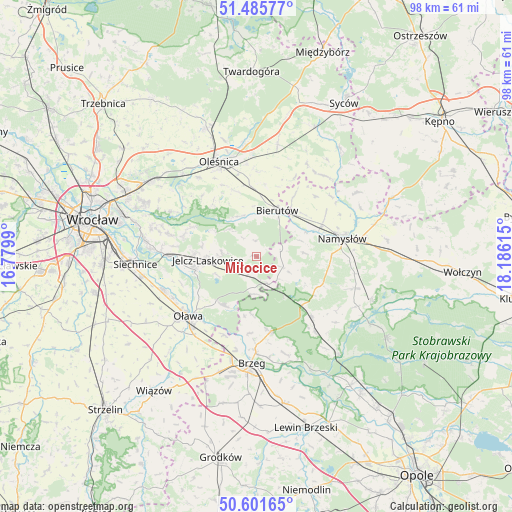
Miłocice GPS coordinates[2]
51° 2' 44.952" North, 17° 28' 58.872" East
| Map corner | latitude | longitude |
|---|---|---|
| Upper-left | 51.48577°, | 16.7799° |
| Center: | 51.04582°, | 17.48302° |
| Lower-right: | 50.60165°, | 18.18615° |
| Map W x H: | 98.3×98.3 km | = 61.1×61.1mi |
| max Lat: | 54.83135° ⇑54.1% North |
| Miłocice: | 51.04582° |
| min Lat: | ⇓45.9% South 49.21328° |
| min Long | Miłocice | max Long |
| 14.20249° | 17.48302° | 24.03723° |
| W 19.9%⇐ | ⇒80.1% E |
Elevation
Elevation of Miłocice is 142 m = 466 ft, and this is 49.4 m = 162 ft below average elevation for this country.
| Max E: |
974 m = 3196 ft | 62.1% |
| Avg. | 191.4 m = 628 ft | |
| Miłocice | 142 m = 466 ft | |
Min E: |
-3 m = -10 ft | 37.9% |
See also: Poland elevation on elevation.city.
Geographical zone
Miłocice is located in North temperate zone (between Tropic of Cancer and the Arctic Circle). Distance of this North polar circle is 1725.4 km =1072.1 mi to North.| Distance of | km | miles | from Miłocice |
|---|---|---|---|
| North Pole | 4331.3 | 2691.3 | to North |
| Arctic Circle | 1725.4 | 1072.1 | to North |
| Tropic Cancer | 3069.8 | 1907.5 | to South |
| Equator | 5675.8 | 3526.8 | to South |


Nearby cities:
15 places around Miłocice: (largest is in red/bold)
• Bierutów
9.8 km =6.1 mi,  26°
26°
• Bystrzyca
11.2 km =7 mi,  212°
212°
• Czernica
16.6 km =10.3 mi,  270°
270°
• Idzikowice
18.5 km =11.5 mi,  52°
52°
• Jelcz
11.7 km =7.3 mi,  256°
256°
• Jelcz Laskowice
12 km =7.5 mi, 256°
• Lubsza
14.7 km =9.1 mi,  169°
169°
• Minkowice Oławskie
3.4 km =2.1 mi, 206°
• Miłoszyce
11.9 km =7.4 mi, 272°
• Namysłów
17.1 km =10.6 mi,  78°
78°
• Oleśnica
19.7 km =12.2 mi,  340°
340°
• Oława
17.3 km =10.7 mi,  230°
230°
• Ratowice
14.8 km =9.2 mi, 264°
• Solniki Wielkie
13.2 km =8.2 mi,  357°
357°
• Wilków
14 km =8.7 mi,  63°
63°
Sources, notices
• [Note1] Compared only with cities in Poland existing in our database
• [Src1] Map data: © OpenStreetMap contributors (CC-BY-SA)
• [Src2] Other city data from geonames.org with taken over terms of usage.
• [Src3] Geographical zone / Annual Mean Temperature by Robert A. Rohde @ Wikipedia
