Zaklików geodata
Zaklików (Subcarpathian) is a seat of a third-order administrative division; located in Poland in Europe/Warsaw (GMT+2) time zone. With population of 3,000 people, there are 1040 cities with bigger population in this country. Compared to other cities in Poland, 61.1% of cities are located further ↑North; 86.1% of cities are located further ←West and 53% of cities have lower elevation than Zaklików. Note1


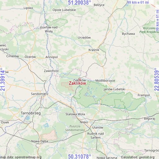
Zaklików GPS coordinates[2]
50° 45' 27.684" North, 22° 6' 8.136" East
| Map corner | latitude | longitude |
|---|---|---|
| Upper-left | 51.20038°, | 21.39914° |
| Center: | 50.75769°, | 22.10226° |
| Lower-right: | 50.31078°, | 22.80539° |
| Map W x H: | 98.9×98.9 km | = 61.5×61.5mi |
| max Lat: | 54.83135° ⇑61.1% North |
| Zaklików: | 50.75769° |
| min Lat: | ⇓38.9% South 49.21328° |
| min Long | Zaklików | max Long |
| 14.20249° | 22.10226° | 24.03723° |
| W 86.1%⇐ | ⇒13.9% E |
Elevation
Elevation of Zaklików is 180 m = 591 ft, and this is 11.4 m = 37 ft below average elevation for this country.
| Max E: |
974 m = 3196 ft | 47% |
| Avg. | 191.4 m = 628 ft | |
| Zaklików | 180 m = 591 ft | |
Min E: |
-3 m = -10 ft | 53% |
See also: Poland elevation on elevation.city.
Geographical zone
Zaklików is located in North temperate zone (between Tropic of Cancer and the Arctic Circle). Distance of this North polar circle is 1757.4 km =1092 mi to North.| Distance of | km | miles | from Zaklików |
|---|---|---|---|
| North Pole | 4363.3 | 2711.2 | to North |
| Arctic Circle | 1757.4 | 1092 | to North |
| Tropic Cancer | 3037.8 | 1887.6 | to South |
| Equator | 5643.7 | 3506.8 | to South |


Nearby cities:
15 places around Zaklików: (largest is in red/bold)
• Chwałowice
15.2 km =9.4 mi,  273°
273°
• Gościeradów
14.1 km =8.8 mi,  331°
331°
• Księżomierz
18.5 km =11.5 mi, 334°
• Modliborzyce
16 km =9.9 mi,  91°
91°
• Potok Wielki
8.9 km =5.5 mi,  64°
64°
• Radomyśl
14 km =8.7 mi,  232°
232°
• Rzeczyca Ziemiańska
11.2 km =7 mi,  31°
31°
• Stalowa Wola
19.7 km =12.2 mi,  190°
190°
• Szastarka
18.7 km =11.6 mi,  54°
54°
• Trzydnik Duży
10.4 km =6.5 mi,  12°
12°
• Zaleszany
19.3 km =12 mi, 230°
• Zawichost
18.3 km =11.4 mi,  287°
287°
• Zdziechowice Drugie
3.1 km =1.9 mi, 10°
• Zdziechowice Pierwsze
3.9 km =2.4 mi,  4°
4°
• Żabno
13.1 km =8.1 mi, 225°
Sources, notices
• [Note1] Compared only with cities in Poland existing in our database
• [Src1] Map data: © OpenStreetMap contributors (CC-BY-SA)
• [Src2] Other city data from geonames.org with taken over terms of usage.
• [Src3] Geographical zone / Annual Mean Temperature by Robert A. Rohde @ Wikipedia
