Żabno geodata
Żabno (Subcarpathian) is a populated place; located in Poland in Europe/Warsaw (GMT+2) time zone. With population of 600 people, there are 3270 cities with bigger population in this country. Compared to other cities in Poland, 63.2% of cities are located further ↑North; 84.5% of cities are located further ←West and 61.1% of cities have higher elevation than Żabno. Note1
Administrative division(s):
- Level 1: Subcarpathian
- Level 2: Powiat stalowowolski
- Level 3: Radomyśl nad Sanem


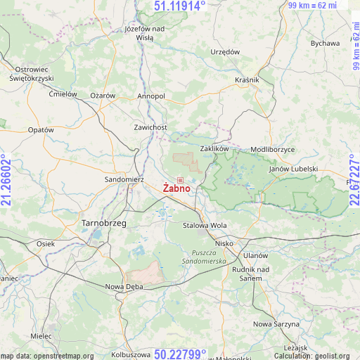
Żabno GPS coordinates[2]
50° 40' 32.448" North, 21° 58' 8.904" East
| Map corner | latitude | longitude |
|---|---|---|
| Upper-left | 51.11914°, | 21.26602° |
| Center: | 50.67568°, | 21.96914° |
| Lower-right: | 50.22799°, | 22.67227° |
| Map W x H: | 99.1×99.1 km | = 61.6×61.6mi |
| max Lat: | 54.83135° ⇑63.2% North |
| Żabno: | 50.67568° |
| min Lat: | ⇓36.8% South 49.21328° |
| min Long | Żabno | max Long |
| 14.20249° | 21.96914° | 24.03723° |
| W 84.5%⇐ | ⇒15.5% E |
Elevation
Elevation of Żabno is 144 m = 472 ft, and this is 47.4 m = 156 ft below average elevation for this country.
| Max E: |
974 m = 3196 ft | 61.1% |
| Avg. | 191.4 m = 628 ft | |
| Żabno | 144 m = 472 ft | |
Min E: |
-3 m = -10 ft | 38.9% |
See also: Poland elevation on elevation.city.
Geographical zone
Żabno is located in North temperate zone (between Tropic of Cancer and the Arctic Circle). Distance of this North polar circle is 1766.6 km =1097.7 mi to North.| Distance of | km | miles | from Żabno |
|---|---|---|---|
| North Pole | 4372.5 | 2716.9 | to North |
| Arctic Circle | 1766.6 | 1097.7 | to North |
| Tropic Cancer | 3028.7 | 1881.9 | to South |
| Equator | 5634.6 | 3501.2 | to South |


Nearby cities:
15 places around Żabno: (largest is in red/bold)
• Chwałowice
11.7 km =7.3 mi,  330°
330°
• Dwikozy
14.4 km =8.9 mi,  297°
297°
• Gorzyce
9.1 km =5.7 mi,  264°
264°
• Grębów
14 km =8.7 mi,  208°
208°
• Kępie Żaleszańskie
7.4 km =4.6 mi,  237°
237°
• Pysznica
16.3 km =10.1 mi,  136°
136°
• Radomyśl
1.9 km =1.2 mi,  288°
288°
• Sandomierz
15.5 km =9.6 mi,  272°
272°
• Sokolniki
12.2 km =7.6 mi,  249°
249°
• Stalowa Wola
11.9 km =7.4 mi,  150°
150°
• Zaklików
13.1 km =8.1 mi,  45°
45°
• Zaleszany
6.3 km =3.9 mi, 240°
• Zawichost
16.7 km =10.4 mi, 331°
• Zdziechowice Drugie
15.7 km =9.8 mi,  39°
39°
• Zdziechowice Pierwsze
16.2 km =10.1 mi, 36°
Sources, notices
• [Note1] Compared only with cities in Poland existing in our database
• [Src1] Map data: © OpenStreetMap contributors (CC-BY-SA)
• [Src2] Other city data from geonames.org with taken over terms of usage.
• [Src3] Geographical zone / Annual Mean Temperature by Robert A. Rohde @ Wikipedia
