Potok Wielki geodata
Potok Wielki (Lublin) is a seat of a third-order administrative division; located in Poland in Europe/Warsaw (GMT+2) time zone. With population of 502 people, there are 3536 cities with bigger population in this country. Compared to other cities in Poland, 60.4% of cities are located further ↑North; 87.5% of cities are located further ←West and 62.4% of cities have lower elevation than Potok Wielki. Note1


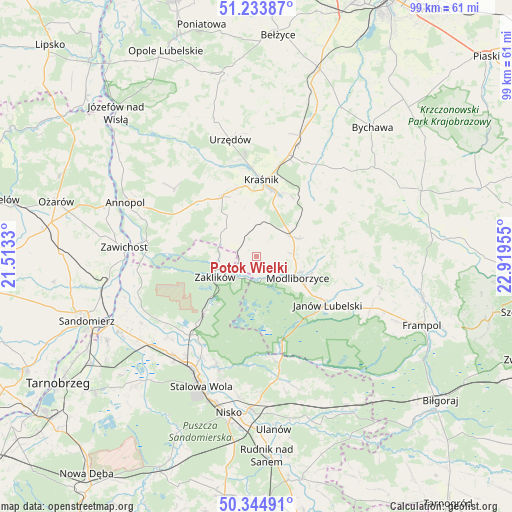
Potok Wielki GPS coordinates[2]
50° 47' 29.4" North, 22° 12' 59.112" East
| Map corner | latitude | longitude |
|---|---|---|
| Upper-left | 51.23387°, | 21.5133° |
| Center: | 50.7915°, | 22.21642° |
| Lower-right: | 50.34491°, | 22.91955° |
| Map W x H: | 98.8×98.8 km | = 61.4×61.4mi |
| max Lat: | 54.83135° ⇑60.4% North |
| Potok Wielki: | 50.7915° |
| min Lat: | ⇓39.6% South 49.21328° |
| min Long | Potok Wielki | max Long |
| 14.20249° | 22.21642° | 24.03723° |
| W 87.5%⇐ | ⇒12.5% E |
Elevation
Elevation of Potok Wielki is 207 m = 679 ft, and this is 15.6 m = 51 ft above average elevation for this country.
| Max E: |
974 m = 3196 ft | 37.6% |
| Potok Wielki | 207 m 679 ft | |
| Avg. | 191.4 m = 628 ft | |
Min E: |
-3 m = -10 ft | 62.4% |
See also: Poland elevation on elevation.city.
Geographical zone
Potok Wielki is located in North temperate zone (between Tropic of Cancer and the Arctic Circle). Distance of this North polar circle is 1753.7 km =1089.7 mi to North.| Distance of | km | miles | from Potok Wielki |
|---|---|---|---|
| North Pole | 4359.6 | 2708.9 | to North |
| Arctic Circle | 1753.7 | 1089.7 | to North |
| Tropic Cancer | 3041.6 | 1890 | to South |
| Equator | 5647.5 | 3509.2 | to South |


Nearby cities:
15 places around Potok Wielki: (largest is in red/bold)
• Batorz
20.5 km =12.7 mi,  71°
71°
• Godziszów
20.4 km =12.7 mi,  103°
103°
• Godziszów Pierwszy
19.2 km =11.9 mi, 101°
• Gościeradów
17.1 km =10.6 mi,  300°
300°
• Janów Lubelski
16.6 km =10.3 mi,  124°
124°
• Kraśnik
14.7 km =9.1 mi,  2°
2°
• Ludmiłówka
20.3 km =12.6 mi,  320°
320°
• Modliborzyce
9 km =5.6 mi, 117°
• Rzeczyca Ziemiańska
6.2 km =3.9 mi,  338°
338°
• Sułów
16.3 km =10.1 mi,  38°
38°
• Szastarka
10.1 km =6.3 mi,  45°
45°
• Trzydnik Duży
8.6 km =5.3 mi, 317°
• Zaklików
8.9 km =5.5 mi,  244°
244°
• Zdziechowice Drugie
7.5 km =4.7 mi,  264°
264°
• Zdziechowice Pierwsze
7.7 km =4.8 mi,  271°
271°
Sources, notices
• [Note1] Compared only with cities in Poland existing in our database
• [Src1] Map data: © OpenStreetMap contributors (CC-BY-SA)
• [Src2] Other city data from geonames.org with taken over terms of usage.
• [Src3] Geographical zone / Annual Mean Temperature by Robert A. Rohde @ Wikipedia
