Wesoła geodata
Wesoła (Subcarpathian) is a populated place; located in Poland in Europe/Warsaw (GMT+2) time zone. With population of 2,048 people, there are 1449 cities with bigger population in this country. Compared to other cities in Poland, 91.7% of cities are located further ↑North; 86% of cities are located further ←West and 86.2% of cities have lower elevation than Wesoła. Note1


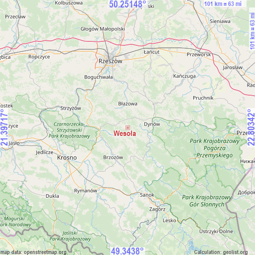
Wesoła GPS coordinates[2]
49° 47' 59.172" North, 22° 6' 1.044" East
| Map corner | latitude | longitude |
|---|---|---|
| Upper-left | 50.25148°, | 21.39717° |
| Center: | 49.79977°, | 22.10029° |
| Lower-right: | 49.3438°, | 22.80342° |
| Map W x H: | 100.9×100.9 km | = 62.7×62.7mi |
| max Lat: | 54.83135° ⇑91.7% North |
| Wesoła: | 49.79977° |
| min Lat: | ⇓8.3% South 49.21328° |
| min Long | Wesoła | max Long |
| 14.20249° | 22.10029° | 24.03723° |
| W 86%⇐ | ⇒14% E |
Elevation
Elevation of Wesoła is 297 m = 974 ft, and this is 105.6 m = 346 ft above average elevation for this country.
| Max E: |
974 m = 3196 ft | 13.8% |
| Wesoła | 297 m 974 ft | |
| Avg. | 191.4 m = 628 ft | |
Min E: |
-3 m = -10 ft | 86.2% |
See also: Poland elevation on elevation.city.
Geographical zone
Wesoła is located in North temperate zone (between Tropic of Cancer and the Arctic Circle). Distance of this North polar circle is 1864 km =1158.2 mi to North.| Distance of | km | miles | from Wesoła |
|---|---|---|---|
| North Pole | 4469.8 | 2777.4 | to North |
| Arctic Circle | 1864 | 1158.2 | to North |
| Tropic Cancer | 2931.3 | 1821.4 | to South |
| Equator | 5537.2 | 3440.7 | to South |


Nearby cities:
15 places around Wesoła: (largest is in red/bold)
• Białka
9.2 km =5.7 mi,  329°
329°
• Blizne
10.5 km =6.5 mi,  240°
240°
• Brzozów
13 km =8.1 mi,  206°
206°
• Błażowa
9.5 km =5.9 mi,  0°
0°
• Domaradz
11.2 km =7 mi,  262°
262°
• Dynów
9.7 km =6 mi,  79°
79°
• Golcowa
6.2 km =3.9 mi, 239°
• Gwoźnica Górna
8 km =5 mi,  293°
293°
• Jabłonka
11.8 km =7.3 mi,  174°
174°
• Jasienica Rosielna
12.6 km =7.8 mi, 244°
• Konieczkowa
13.2 km =8.2 mi, 290°
• Lecka
10.7 km =6.6 mi,  324°
324°
• Nozdrzec
7.7 km =4.8 mi,  112°
112°
• Orzechówka
13.5 km =8.4 mi, 235°
• Stara Wieś
11.7 km =7.3 mi,  216°
216°
Sources, notices
• [Note1] Compared only with cities in Poland existing in our database
• [Src1] Map data: © OpenStreetMap contributors (CC-BY-SA)
• [Src2] Other city data from geonames.org with taken over terms of usage.
• [Src3] Geographical zone / Annual Mean Temperature by Robert A. Rohde @ Wikipedia
