Nozdrzec geodata
Nozdrzec (Subcarpathian) is a seat of a third-order administrative division; located in Poland in Europe/Warsaw (GMT+2) time zone. With population of 1,300 people, there are 2055 cities with bigger population in this country. Compared to other cities in Poland, 92.7% of cities are located further ↑North; 87.3% of cities are located further ←West and 79.4% of cities have lower elevation than Nozdrzec. Note1


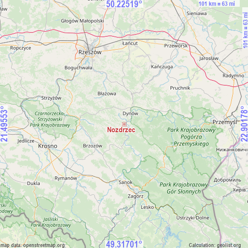
Nozdrzec GPS coordinates[2]
49° 46' 23.628" North, 22° 11' 55.14" East
| Map corner | latitude | longitude |
|---|---|---|
| Upper-left | 50.22519°, | 21.49553° |
| Center: | 49.77323°, | 22.19865° |
| Lower-right: | 49.31701°, | 22.90178° |
| Map W x H: | 101×101 km | = 62.8×62.8mi |
| max Lat: | 54.83135° ⇑92.7% North |
| Nozdrzec: | 49.77323° |
| min Lat: | ⇓7.3% South 49.21328° |
| min Long | Nozdrzec | max Long |
| 14.20249° | 22.19865° | 24.03723° |
| W 87.3%⇐ | ⇒12.7% E |
Elevation
Elevation of Nozdrzec is 263 m = 863 ft, and this is 71.6 m = 235 ft above average elevation for this country.
| Max E: |
974 m = 3196 ft | 20.6% |
| Nozdrzec | 263 m 863 ft | |
| Avg. | 191.4 m = 628 ft | |
Min E: |
-3 m = -10 ft | 79.4% |
See also: Poland elevation on elevation.city.
Geographical zone
Nozdrzec is located in North temperate zone (between Tropic of Cancer and the Arctic Circle). Distance of this North polar circle is 1866.9 km =1160 mi to North.| Distance of | km | miles | from Nozdrzec |
|---|---|---|---|
| North Pole | 4472.8 | 2779.3 | to North |
| Arctic Circle | 1866.9 | 1160 | to North |
| Tropic Cancer | 2928.3 | 1819.6 | to South |
| Equator | 5534.3 | 3438.9 | to South |


Nearby cities:
15 places around Nozdrzec: (largest is in red/bold)
• Brzozów
15.6 km =9.7 mi,  235°
235°
• Błażowa
14.3 km =8.9 mi,  330°
330°
• Drohobyczka
14.7 km =9.1 mi,  50°
50°
• Dubiecko
15 km =9.3 mi,  66°
66°
• Dydnia
9.8 km =6.1 mi,  191°
191°
• Dynów
5.3 km =3.3 mi,  28°
28°
• Golcowa
12.5 km =7.8 mi,  269°
269°
• Grabownica Starzeńska
15.4 km =9.6 mi,  214°
214°
• Humniska
15.1 km =9.4 mi,  223°
223°
• Jabłonka
10.6 km =6.6 mi, 214°
• Jawornik Polski
14.6 km =9.1 mi, 26°
• Niebocko
12.6 km =7.8 mi, 212°
• Przedmieście Dubieckie
14.3 km =8.9 mi,  60°
60°
• Stara Wieś
15.4 km =9.6 mi,  245°
245°
• Wesoła
7.7 km =4.8 mi,  292°
292°
Sources, notices
• [Note1] Compared only with cities in Poland existing in our database
• [Src1] Map data: © OpenStreetMap contributors (CC-BY-SA)
• [Src2] Other city data from geonames.org with taken over terms of usage.
• [Src3] Geographical zone / Annual Mean Temperature by Robert A. Rohde @ Wikipedia
