Domaradz geodata
Domaradz (Subcarpathian) is a seat of a third-order administrative division; located in Poland in Europe/Warsaw (GMT+2) time zone. With population of 3,100 people, there are 1018 cities with bigger population in this country. Compared to other cities in Poland, 92.2% of cities are located further ↑North; 84.1% of cities are located further ←West and 77.6% of cities have lower elevation than Domaradz. Note1


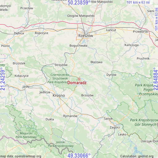
Domaradz GPS coordinates[2]
49° 47' 12.3" North, 21° 56' 44.556" East
| Map corner | latitude | longitude |
|---|---|---|
| Upper-left | 50.23859°, | 21.24259° |
| Center: | 49.78675°, | 21.94571° |
| Lower-right: | 49.33066°, | 22.64884° |
| Map W x H: | 101×101 km | = 62.8×62.8mi |
| max Lat: | 54.83135° ⇑92.2% North |
| Domaradz: | 49.78675° |
| min Lat: | ⇓7.8% South 49.21328° |
| min Long | Domaradz | max Long |
| 14.20249° | 21.94571° | 24.03723° |
| W 84.1%⇐ | ⇒15.9% E |
Elevation
Elevation of Domaradz is 256 m = 840 ft, and this is 64.6 m = 212 ft above average elevation for this country.
| Max E: |
974 m = 3196 ft | 22.4% |
| Domaradz | 256 m 840 ft | |
| Avg. | 191.4 m = 628 ft | |
Min E: |
-3 m = -10 ft | 77.6% |
See also: Poland elevation on elevation.city.
Geographical zone
Domaradz is located in North temperate zone (between Tropic of Cancer and the Arctic Circle). Distance of this North polar circle is 1865.4 km =1159.1 mi to North.| Distance of | km | miles | from Domaradz |
|---|---|---|---|
| North Pole | 4471.3 | 2778.3 | to North |
| Arctic Circle | 1865.4 | 1159.1 | to North |
| Tropic Cancer | 2929.8 | 1820.5 | to South |
| Equator | 5535.8 | 3439.8 | to South |


Nearby cities:
15 places around Domaradz: (largest is in red/bold)
• Białka
11.3 km =7 mi,  34°
34°
• Blizne
4.2 km =2.6 mi,  151°
151°
• Golcowa
5.9 km =3.7 mi,  106°
106°
• Gwoźnica Górna
5.9 km =3.7 mi,  39°
39°
• Jabłonica Polska
10.4 km =6.5 mi,  198°
198°
• Jasienica Rosielna
3.9 km =2.4 mi,  184°
184°
• Jawornik
7.6 km =4.7 mi,  330°
330°
• Konieczkowa
6.3 km =3.9 mi,  348°
348°
• Krasna
6.8 km =4.2 mi,  259°
259°
• Lecka
11.3 km =7 mi, 25°
• Malinówka
10.1 km =6.3 mi,  187°
187°
• Niebylec
8.3 km =5.2 mi,  338°
338°
• Orzechówka
6.2 km =3.9 mi, 180°
• Stara Wieś
9 km =5.6 mi, 152°
• Wesoła
11.2 km =7 mi,  82°
82°
Sources, notices
• [Note1] Compared only with cities in Poland existing in our database
• [Src1] Map data: © OpenStreetMap contributors (CC-BY-SA)
• [Src2] Other city data from geonames.org with taken over terms of usage.
• [Src3] Geographical zone / Annual Mean Temperature by Robert A. Rohde @ Wikipedia
