Rychwałd geodata
Rychwałd (Lesser Poland) is a populated place; located in Poland in Europe/Warsaw (GMT+2) time zone. With population of 680 people, there are 3110 cities with bigger population in this country. Compared to other cities in Poland, 87.2% of cities are located further ↑North; 71.3% of cities are located further ←West and 86.9% of cities have lower elevation than Rychwałd. Note1


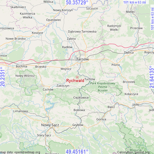
Rychwałd GPS coordinates[2]
49° 54' 23.688" North, 20° 56' 17.592" East
| Map corner | latitude | longitude |
|---|---|---|
| Upper-left | 50.35729°, | 20.2351° |
| Center: | 49.90658°, | 20.93822° |
| Lower-right: | 49.45161°, | 21.64135° |
| Map W x H: | 100.7×100.7 km | = 62.6×62.6mi |
| max Lat: | 54.83135° ⇑87.2% North |
| Rychwałd: | 49.90658° |
| min Lat: | ⇓12.8% South 49.21328° |
| min Long | Rychwałd | max Long |
| 14.20249° | 20.93822° | 24.03723° |
| W 71.3%⇐ | ⇒28.7% E |
Elevation
Elevation of Rychwałd is 300 m = 984 ft, and this is 108.6 m = 356 ft above average elevation for this country.
| Max E: |
974 m = 3196 ft | 13.1% |
| Rychwałd | 300 m 984 ft | |
| Avg. | 191.4 m = 628 ft | |
Min E: |
-3 m = -10 ft | 86.9% |
See also: Poland elevation on elevation.city.
Geographical zone
Rychwałd is located in North temperate zone (between Tropic of Cancer and the Arctic Circle). Distance of this North polar circle is 1852.1 km =1150.8 mi to North.| Distance of | km | miles | from Rychwałd |
|---|---|---|---|
| North Pole | 4458 | 2770.1 | to North |
| Arctic Circle | 1852.1 | 1150.8 | to North |
| Tropic Cancer | 2943.2 | 1828.8 | to South |
| Equator | 5549.1 | 3448 | to South |


Nearby cities:
15 places around Rychwałd: (largest is in red/bold)
• Błonie
5.6 km =3.5 mi,  333°
333°
• Gromnik
7.8 km =4.8 mi,  167°
167°
• Janowice
5.8 km =3.6 mi,  253°
253°
• Koszyce
7.3 km =4.5 mi,  1°
1°
• Koszyce Wielkie
8.3 km =5.2 mi, 3°
• Lubaszowa
8.8 km =5.5 mi,  126°
126°
• Olszyny
8.7 km =5.4 mi,  259°
259°
• Pleśna
2.3 km =1.4 mi,  12°
12°
• Siedliska
5.7 km =3.5 mi, 133°
• Siemiechów
6.3 km =3.9 mi,  201°
201°
• Tarnowiec
9 km =5.6 mi,  22°
22°
• Tuchów
8.4 km =5.2 mi,  98°
98°
• Wielka Wieś
8.9 km =5.5 mi,  291°
291°
• Wojnicz
9.2 km =5.7 mi,  308°
308°
• Wróblowice
6.8 km =4.2 mi,  241°
241°
Sources, notices
• [Note1] Compared only with cities in Poland existing in our database
• [Src1] Map data: © OpenStreetMap contributors (CC-BY-SA)
• [Src2] Other city data from geonames.org with taken over terms of usage.
• [Src3] Geographical zone / Annual Mean Temperature by Robert A. Rohde @ Wikipedia
