Niepołomice geodata
Niepołomice (Lesser Poland) is a seat of a third-order administrative division; located in Poland in Europe/Warsaw (GMT+2) time zone. With population of 9,384 people, there are 465 cities with bigger population in this country. Compared to other cities in Poland, 80.5% of cities are located further ↑North; 61.3% of cities are located further ←West and 56.8% of cities have lower elevation than Niepołomice. Note1


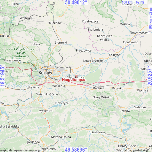
Niepołomice GPS coordinates[2]
50° 2' 26.376" North, 20° 13' 21.252" East
| Map corner | latitude | longitude |
|---|---|---|
| Upper-left | 50.49012°, | 19.51945° |
| Center: | 50.04066°, | 20.22257° |
| Lower-right: | 49.58696°, | 20.9257° |
| Map W x H: | 100.4×100.4 km | = 62.4×62.4mi |
| max Lat: | 54.83135° ⇑80.5% North |
| Niepołomice: | 50.04066° |
| min Lat: | ⇓19.5% South 49.21328° |
| min Long | Niepołomice | max Long |
| 14.20249° | 20.22257° | 24.03723° |
| W 61.3%⇐ | ⇒38.7% E |
Elevation
Elevation of Niepołomice is 190 m = 623 ft, and this is 1.4 m = 5 ft below average elevation for this country.
| Max E: |
974 m = 3196 ft | 43.2% |
| Avg. | 191.4 m = 628 ft | |
| Niepołomice | 190 m = 623 ft | |
Min E: |
-3 m = -10 ft | 56.8% |
See also: Poland elevation on elevation.city.
Geographical zone
Niepołomice is located in North temperate zone (between Tropic of Cancer and the Arctic Circle). Distance of this North polar circle is 1837.2 km =1141.6 mi to North.| Distance of | km | miles | from Niepołomice |
|---|---|---|---|
| North Pole | 4443.1 | 2760.8 | to North |
| Arctic Circle | 1837.2 | 1141.6 | to North |
| Tropic Cancer | 2958.1 | 1838.1 | to South |
| Equator | 5564 | 3457.3 | to South |


Nearby cities:
15 places around Niepołomice: (largest is in red/bold)
• Cichawa
10.5 km =6.5 mi,  162°
162°
• Dąbrowa
4.4 km =2.7 mi,  149°
149°
• Kłaj
7.7 km =4.8 mi,  134°
134°
• Podłęże
4.9 km =3 mi,  233°
233°
• Szarów
6.1 km =3.8 mi, 146°
• Szczytniki
7.4 km =4.6 mi,  175°
175°
• Targowisko
8 km =5 mi,  140°
140°
• Trąbki
10.4 km =6.5 mi,  213°
213°
• Wawrzeńczyce
10.2 km =6.3 mi,  40°
40°
• Wola Batorska
3.4 km =2.1 mi,  66°
66°
• Wola Zabierzowska
8.6 km =5.3 mi, 65°
• Węgrzce Wielkie
8.5 km =5.3 mi,  250°
250°
• Zabawa
10.7 km =6.6 mi,  241°
241°
• Zabierzów Bocheński
7.5 km =4.7 mi, 66°
• Śledziejowice
10.8 km =6.7 mi, 247°
Sources, notices
• [Note1] Compared only with cities in Poland existing in our database
• [Src1] Map data: © OpenStreetMap contributors (CC-BY-SA)
• [Src2] Other city data from geonames.org with taken over terms of usage.
• [Src3] Geographical zone / Annual Mean Temperature by Robert A. Rohde @ Wikipedia
