Wawrzeńczyce geodata
Wawrzeńczyce (Lesser Poland) is a populated place; located in Poland in Europe/Warsaw (GMT+2) time zone. With population of 3,000 people, there are 1040 cities with bigger population in this country. Compared to other cities in Poland, 77.5% of cities are located further ↑North; 62.8% of cities are located further ←West and 59.2% of cities have lower elevation than Wawrzeńczyce. Note1
Administrative division(s):
- Level 1: Lesser Poland
- Level 2: Powiat krakowski
- Level 3: Igołomia-Wawrzeńczyce


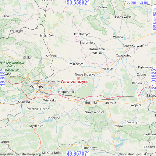
Wawrzeńczyce GPS coordinates[2]
50° 6' 36.432" North, 20° 18' 58.032" East
| Map corner | latitude | longitude |
|---|---|---|
| Upper-left | 50.55892°, | 19.613° |
| Center: | 50.11012°, | 20.31612° |
| Lower-right: | 49.65707°, | 21.01925° |
| Map W x H: | 100.3×100.3 km | = 62.3×62.3mi |
| max Lat: | 54.83135° ⇑77.5% North |
| Wawrzeńczyce: | 50.11012° |
| min Lat: | ⇓22.5% South 49.21328° |
| min Long | Wawrzeńczyce | max Long |
| 14.20249° | 20.31612° | 24.03723° |
| W 62.8%⇐ | ⇒37.2% E |
Elevation
Elevation of Wawrzeńczyce is 198 m = 650 ft, and this is 6.6 m = 22 ft above average elevation for this country.
| Max E: |
974 m = 3196 ft | 40.8% |
| Wawrzeńczyce | 198 m 650 ft | |
| Avg. | 191.4 m = 628 ft | |
Min E: |
-3 m = -10 ft | 59.2% |
See also: Poland elevation on elevation.city.
Geographical zone
Wawrzeńczyce is located in North temperate zone (between Tropic of Cancer and the Arctic Circle). Distance of this North polar circle is 1829.5 km =1136.8 mi to North.| Distance of | km | miles | from Wawrzeńczyce |
|---|---|---|---|
| North Pole | 4435.3 | 2756 | to North |
| Arctic Circle | 1829.5 | 1136.8 | to North |
| Tropic Cancer | 2965.8 | 1842.9 | to South |
| Equator | 5571.7 | 3462.1 | to South |


Nearby cities:
15 places around Wawrzeńczyce: (largest is in red/bold)
• Baczków
12.3 km =7.6 mi,  133°
133°
• Drwinia
9.1 km =5.7 mi,  98°
98°
• Dziewin
10.6 km =6.6 mi,  111°
111°
• Dąbrowa
12.3 km =7.6 mi,  200°
200°
• Grobla
8 km =5 mi,  77°
77°
• Klimontów
13.2 km =8.2 mi,  1°
1°
• Kościelec
11.4 km =7.1 mi,  28°
28°
• Kłaj
13.1 km =8.1 mi,  185°
185°
• Niepołomice
10.2 km =6.3 mi,  220°
220°
• Nowe Brzesko
5 km =3.1 mi,  60°
60°
• Proszowice
9.4 km =5.8 mi,  348°
348°
• Szarów
13.2 km =8.2 mi, 194°
• Wola Batorska
7.3 km =4.5 mi,  209°
209°
• Wola Zabierzowska
4.3 km =2.7 mi,  164°
164°
• Zabierzów Bocheński
4.7 km =2.9 mi,  177°
177°
Sources, notices
• [Note1] Compared only with cities in Poland existing in our database
• [Src1] Map data: © OpenStreetMap contributors (CC-BY-SA)
• [Src2] Other city data from geonames.org with taken over terms of usage.
• [Src3] Geographical zone / Annual Mean Temperature by Robert A. Rohde @ Wikipedia
