Łosice geodata
Łosice (Mazovia) is a populated place; located in Poland in Europe/Warsaw (GMT+2) time zone. With population of 7,207 people, there are 527 cities with bigger population in this country. Compared to other cities in Poland, 70.4% of cities are located further ↓South; 94% of cities are located further ←West and 58.4% of cities have higher elevation than Łosice. Note1


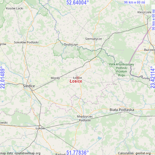
Łosice GPS coordinates[2]
52° 12' 40.644" North, 22° 43' 4.836" East
| Map corner | latitude | longitude |
|---|---|---|
| Upper-left | 52.64004°, | 22.01489° |
| Center: | 52.21129°, | 22.71801° |
| Lower-right: | 51.77836°, | 23.42114° |
| Map W x H: | 95.8×95.8 km | = 59.5×59.5mi |
| max Lat: | 54.83135° ⇑29.6% North |
| Łosice: | 52.21129° |
| min Lat: | ⇓70.4% South 49.21328° |
| min Long | Łosice | max Long |
| 14.20249° | 22.71801° | 24.03723° |
| W 94%⇐ | ⇒6% E |
Elevation
Elevation of Łosice is 150 m = 492 ft, and this is 41.4 m = 136 ft below average elevation for this country.
| Max E: |
974 m = 3196 ft | 58.4% |
| Avg. | 191.4 m = 628 ft | |
| Łosice | 150 m = 492 ft | |
Min E: |
-3 m = -10 ft | 41.6% |
See also: Poland elevation on elevation.city.
Geographical zone
Łosice is located in North temperate zone (between Tropic of Cancer and the Arctic Circle). Distance of this North polar circle is 1595.8 km =991.6 mi to North.| Distance of | km | miles | from Łosice |
|---|---|---|---|
| North Pole | 4201.7 | 2610.8 | to North |
| Arctic Circle | 1595.8 | 991.6 | to North |
| Tropic Cancer | 3199.4 | 1988 | to South |
| Equator | 5805.4 | 3607.3 | to South |


Nearby cities:
15 places around Łosice: (largest is in red/bold)
• Drohiczyn
21.4 km =13.3 mi,  349°
349°
• Huszlew
11.3 km =7 mi,  135°
135°
• Konstantynów
25 km =15.5 mi,  90°
90°
• Korczew
17.3 km =10.7 mi,  335°
335°
• Leśna Podlaska
22.8 km =14.2 mi,  112°
112°
• Mielnik
25.9 km =16.1 mi,  58°
58°
• Międzyrzec Podlaski
25.4 km =15.8 mi,  170°
170°
• Mordy
13.7 km =8.5 mi,  270°
270°
• Paprotnia
19.7 km =12.2 mi,  300°
300°
• Platerów
12.4 km =7.7 mi,  34°
34°
• Przesmyki
11.1 km =6.9 mi, 304°
• Sarnaki
16.5 km =10.3 mi,  45°
45°
• Siemiatycze
25.9 km =16.1 mi,  22°
22°
• Stara Kornica
15.3 km =9.5 mi,  102°
102°
• Zbuczyn
23.4 km =14.5 mi,  234°
234°
Sources, notices
• [Note1] Compared only with cities in Poland existing in our database
• [Src1] Map data: © OpenStreetMap contributors (CC-BY-SA)
• [Src2] Other city data from geonames.org with taken over terms of usage.
• [Src3] Geographical zone / Annual Mean Temperature by Robert A. Rohde @ Wikipedia
