Kąkolewnica Wschodnia geodata
Kąkolewnica Wschodnia (Lublin) is a populated place; located in Poland in Europe/Warsaw (GMT+2) time zone. With population of 680 people, there are 3110 cities with bigger population in this country. Compared to other cities in Poland, 63.8% of cities are located further ↓South; 93.9% of cities are located further ←West and 58.4% of cities have higher elevation than Kąkolewnica Wschodnia. Note1
Administrative division(s):
- Level 1: Lublin
- Level 2: Powiat radzyński
- Level 3: Kąkolewnica Wschodnia
Current local time in Kąkolewnica Wschodnia:
04:07 AM, SaturdayDifference from your time zone: hours


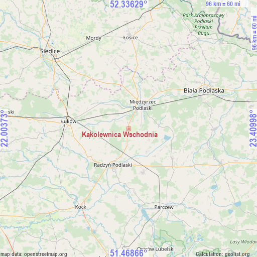
Kąkolewnica Wschodnia GPS coordinates[2]
51° 54' 16.452" North, 22° 42' 24.66" East
| Map corner | latitude | longitude |
|---|---|---|
| Upper-left | 52.33629°, | 22.00373° |
| Center: | 51.90457°, | 22.70685° |
| Lower-right: | 51.46866°, | 23.40998° |
| Map W x H: | 96.5×96.5 km | = 60×60mi |
| max Lat: | 54.83135° ⇑36.2% North |
| Kąkolewnica Wschodnia: | 51.90457° |
| min Lat: | ⇓63.8% South 49.21328° |
| min Long | Kąkolewnica Ws | max Long |
| 14.20249° | 22.70685° | 24.03723° |
| W 93.9%⇐ | ⇒6.1% E |
Elevation
Elevation of Kąkolewnica Wschodnia is 150 m = 492 ft, and this is 41.4 m = 136 ft below average elevation for this country.
| Max E: |
974 m = 3196 ft | 58.4% |
| Avg. | 191.4 m = 628 ft | |
| Kąkolewnica Wschodnia | 150 m = 492 ft | |
Min E: |
-3 m = -10 ft | 41.6% |
See also: Poland elevation on elevation.city.
Geographical zone
Kąkolewnica Wschodnia is located in North temperate zone (between Tropic of Cancer and the Arctic Circle). Distance of this North polar circle is 1629.9 km =1012.8 mi to North.| Distance of | km | miles | from Kąkolewnica Wschodnia |
|---|---|---|---|
| North Pole | 4235.8 | 2632 | to North |
| Arctic Circle | 1629.9 | 1012.8 | to North |
| Tropic Cancer | 3165.3 | 1966.8 | to South |
| Equator | 5771.2 | 3586.1 | to South |


Nearby cities:
15 places around Kąkolewnica Wschodnia: (largest is in red/bold)
• Borki
24 km =14.9 mi,  212°
212°
• Czemierniki
26.2 km =16.3 mi,  190°
190°
• Drelów
11.3 km =7 mi,  85°
85°
• Huszlew
27.4 km =17 mi,  18°
18°
• Komarówka Podlaska
19.8 km =12.3 mi,  124°
124°
• Kostry
27.2 km =16.9 mi,  148°
148°
• Milanów
25.6 km =15.9 mi, 150°
• Międzyrzec Podlaski
10.5 km =6.5 mi,  29°
29°
• Radzyń Podlaski
14.8 km =9.2 mi,  204°
204°
• Rzeczyca
7 km =4.3 mi, 24°
• Sarnów
28.3 km =17.6 mi,  259°
259°
• Trzebieszów
14.1 km =8.8 mi,  312°
312°
• Wohyń
17.3 km =10.7 mi,  161°
161°
• Zbuczyn
27.6 km =17.1 mi,  318°
318°
• Łuków
22.6 km =14 mi,  276°
276°
Sources, notices
• [Note1] Compared only with cities in Poland existing in our database
• [Src1] Map data: © OpenStreetMap contributors (CC-BY-SA)
• [Src2] Other city data from geonames.org with taken over terms of usage.
• [Src3] Geographical zone / Annual Mean Temperature by Robert A. Rohde @ Wikipedia
