Trzebieszów geodata
Trzebieszów (Lublin) is a populated place; located in Poland in Europe/Warsaw (GMT+2) time zone. With population of 1,651 people, there are 1720 cities with bigger population in this country. Compared to other cities in Poland, 65.6% of cities are located further ↓South; 92.3% of cities are located further ←West and 57.6% of cities have higher elevation than Trzebieszów. Note1


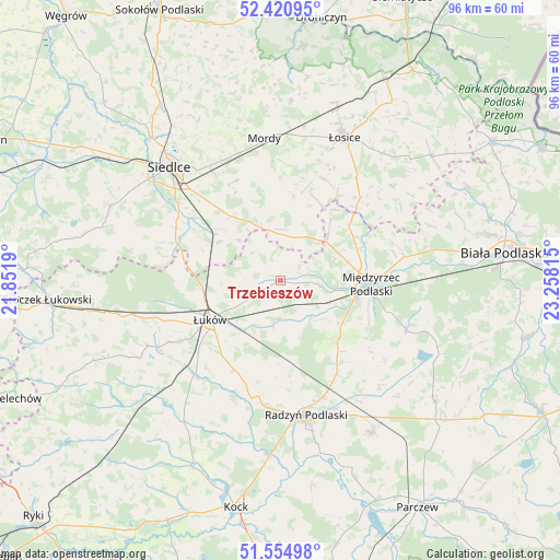
Trzebieszów GPS coordinates[2]
51° 59' 24.216" North, 22° 33' 18.072" East
| Map corner | latitude | longitude |
|---|---|---|
| Upper-left | 52.42095°, | 21.8519° |
| Center: | 51.99006°, | 22.55502° |
| Lower-right: | 51.55498°, | 23.25815° |
| Map W x H: | 96.3×96.3 km | = 59.8×59.8mi |
| max Lat: | 54.83135° ⇑34.4% North |
| Trzebieszów: | 51.99006° |
| min Lat: | ⇓65.6% South 49.21328° |
| min Long | Trzebieszów | max Long |
| 14.20249° | 22.55502° | 24.03723° |
| W 92.3%⇐ | ⇒7.7% E |
Elevation
Elevation of Trzebieszów is 152 m = 499 ft, and this is 39.4 m = 129 ft below average elevation for this country.
| Max E: |
974 m = 3196 ft | 57.6% |
| Avg. | 191.4 m = 628 ft | |
| Trzebieszów | 152 m = 499 ft | |
Min E: |
-3 m = -10 ft | 42.4% |
See also: Poland elevation on elevation.city.
Geographical zone
Trzebieszów is located in North temperate zone (between Tropic of Cancer and the Arctic Circle). Distance of this North polar circle is 1620.4 km =1006.9 mi to North.| Distance of | km | miles | from Trzebieszów |
|---|---|---|---|
| North Pole | 4226.3 | 2626.1 | to North |
| Arctic Circle | 1620.4 | 1006.9 | to North |
| Tropic Cancer | 3174.8 | 1972.7 | to South |
| Equator | 5780.8 | 3592 | to South |


Nearby cities:
15 places around Trzebieszów: (largest is in red/bold)
• Domanice
26.4 km =16.4 mi,  281°
281°
• Drelów
23.4 km =14.5 mi,  111°
111°
• Huszlew
25.2 km =15.7 mi,  49°
49°
• Kąkolewnica Wschodnia
14.1 km =8.8 mi,  132°
132°
• Międzyrzec Podlaski
15.6 km =9.7 mi,  91°
91°
• Mordy
24.8 km =15.4 mi,  354°
354°
• Radzyń Podlaski
23.4 km =14.5 mi,  169°
169°
• Rzeczyca
13.7 km =8.5 mi,  103°
103°
• Sarnów
22.8 km =14.2 mi,  229°
229°
• Siedlce
26.8 km =16.7 mi,  317°
317°
• Stanin
27.6 km =17.1 mi,  241°
241°
• Wiśniew
20.1 km =12.5 mi,  297°
297°
• Zbuczyn
13.7 km =8.5 mi, 324°
• Łosice
27 km =16.8 mi,  24°
24°
• Łuków
13.8 km =8.6 mi, 240°
Sources, notices
• [Note1] Compared only with cities in Poland existing in our database
• [Src1] Map data: © OpenStreetMap contributors (CC-BY-SA)
• [Src2] Other city data from geonames.org with taken over terms of usage.
• [Src3] Geographical zone / Annual Mean Temperature by Robert A. Rohde @ Wikipedia
