Dębów geodata
Dębów (Subcarpathian) is a populated place; located in Poland in Europe/Warsaw (GMT+2) time zone. With population of 1,244 people, there are 2135 cities with bigger population in this country. Compared to other cities in Poland, 80.2% of cities are located further ↑North; 90.8% of cities are located further ←West and 59.4% of cities have lower elevation than Dębów. Note1


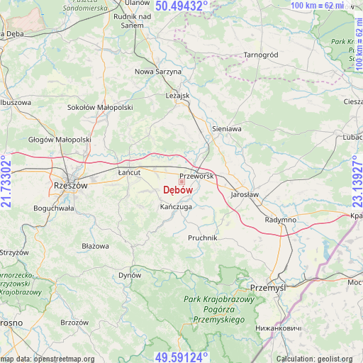
Dębów GPS coordinates[2]
50° 2' 41.64" North, 22° 26' 10.104" East
| Map corner | latitude | longitude |
|---|---|---|
| Upper-left | 50.49432°, | 21.73302° |
| Center: | 50.0449°, | 22.43614° |
| Lower-right: | 49.59124°, | 23.13927° |
| Map W x H: | 100.4×100.4 km | = 62.4×62.4mi |
| max Lat: | 54.83135° ⇑80.2% North |
| Dębów: | 50.0449° |
| min Lat: | ⇓19.8% South 49.21328° |
| min Long | Dębów | max Long |
| 14.20249° | 22.43614° | 24.03723° |
| W 90.8%⇐ | ⇒9.2% E |
Elevation
Elevation of Dębów is 199 m = 653 ft, and this is 7.6 m = 25 ft above average elevation for this country.
| Max E: |
974 m = 3196 ft | 40.6% |
| Dębów | 199 m 653 ft | |
| Avg. | 191.4 m = 628 ft | |
Min E: |
-3 m = -10 ft | 59.4% |
See also: Poland elevation on elevation.city.
Geographical zone
Dębów is located in North temperate zone (between Tropic of Cancer and the Arctic Circle). Distance of this North polar circle is 1836.7 km =1141.3 mi to North.| Distance of | km | miles | from Dębów |
|---|---|---|---|
| North Pole | 4442.6 | 2760.5 | to North |
| Arctic Circle | 1836.7 | 1141.3 | to North |
| Tropic Cancer | 2958.6 | 1838.4 | to South |
| Equator | 5564.5 | 3457.6 | to South |


Nearby cities:
15 places around Dębów: (largest is in red/bold)
• Gać
5.9 km =3.7 mi,  250°
250°
• Gorliczyna
6.4 km =4 mi,  34°
34°
• Grzęska
4.4 km =2.7 mi,  16°
16°
• Kańczuga
7.1 km =4.4 mi,  194°
194°
• Kosina
8.2 km =5.1 mi,  291°
291°
• Krzeczowice
6.5 km =4 mi,  162°
162°
• Markowa
7.7 km =4.8 mi, 254°
• Maćkówka
6 km =3.7 mi,  106°
106°
• Nowosielce
2.3 km =1.4 mi,  307°
307°
• Przeworsk
4.4 km =2.7 mi,  69°
69°
• Rogóźno
5.4 km =3.4 mi, 306°
• Rozbórz
8 km =5 mi,  81°
81°
• Urzejowice
4.1 km =2.5 mi,  153°
153°
• Zalesie
7.8 km =4.8 mi,  117°
117°
• Żurawiczki
5.7 km =3.5 mi,  127°
127°
Sources, notices
• [Note1] Compared only with cities in Poland existing in our database
• [Src1] Map data: © OpenStreetMap contributors (CC-BY-SA)
• [Src2] Other city data from geonames.org with taken over terms of usage.
• [Src3] Geographical zone / Annual Mean Temperature by Robert A. Rohde @ Wikipedia
