Czarna Białostocka geodata
Czarna Białostocka (Podlasie) is a seat of a third-order administrative division; located in Poland in Europe/Warsaw (GMT+2) time zone. With population of 9,592 people, there are 459 cities with bigger population in this country. Compared to other cities in Poland, 87.5% of cities are located further ↓South; 97.7% of cities are located further ←West and 55.6% of cities have higher elevation than Czarna Białostocka. Note1
Administrative division(s):
- Level 1: Podlasie
- Level 2: Powiat białostocki
- Level 3: Czarna Białostocka


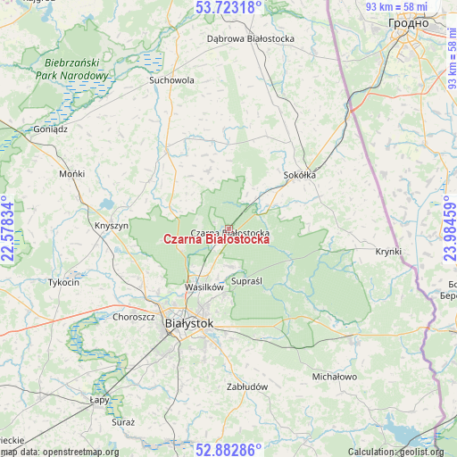
Czarna Białostocka GPS coordinates[2]
53° 18' 18.324" North, 23° 16' 53.256" East
| Map corner | latitude | longitude |
|---|---|---|
| Upper-left | 53.72318°, | 22.57834° |
| Center: | 53.30509°, | 23.28146° |
| Lower-right: | 52.88286°, | 23.98459° |
| Map W x H: | 93.4×93.4 km | = 58×58mi |
| max Lat: | 54.83135° ⇑12.5% North |
| Czarna Białostocka: | 53.30509° |
| min Lat: | ⇓87.5% South 49.21328° |
| min Long | Czarna Białost | max Long |
| 14.20249° | 23.28146° | 24.03723° |
| W 97.7%⇐ | ⇒2.3% E |
Elevation
Elevation of Czarna Białostocka is 157 m = 515 ft, and this is 34.4 m = 113 ft below average elevation for this country.
| Max E: |
974 m = 3196 ft | 55.6% |
| Avg. | 191.4 m = 628 ft | |
| Czarna Białostocka | 157 m = 515 ft | |
Min E: |
-3 m = -10 ft | 44.4% |
See also: Poland elevation on elevation.city.
Geographical zone
Czarna Białostocka is located in North temperate zone (between Tropic of Cancer and the Arctic Circle). Distance of this North polar circle is 1474.2 km =916 mi to North.| Distance of | km | miles | from Czarna Białostocka |
|---|---|---|---|
| North Pole | 4080.1 | 2535.3 | to North |
| Arctic Circle | 1474.2 | 916 | to North |
| Tropic Cancer | 3321.1 | 2063.6 | to South |
| Equator | 5927 | 3682.9 | to South |


Nearby cities:
15 places around Czarna Białostocka: (largest is in red/bold)
• Białystok
20.6 km =12.8 mi,  202°
202°
• Choroszcz
26.5 km =16.5 mi,  227°
227°
• Dobrzyniewo Duże
21.4 km =13.3 mi,  237°
237°
• Janów
18.4 km =11.4 mi,  349°
349°
• Jasionówka
19 km =11.8 mi,  301°
301°
• Jaświły
29.4 km =18.3 mi,  311°
311°
• Knyszyn
24.1 km =15 mi,  272°
272°
• Korycin
20.1 km =12.5 mi,  320°
320°
• Sidra
29.7 km =18.5 mi,  22°
22°
• Sokółka
18.5 km =11.5 mi,  52°
52°
• Suchowola
32.4 km =20.1 mi,  339°
339°
• Supraśl
11.7 km =7.3 mi,  160°
160°
• Szudziałowo
24.8 km =15.4 mi,  91°
91°
• Wasilków
12.8 km =8 mi, 202°
• Złotoria
27.2 km =16.9 mi, 238°
Sources, notices
• [Note1] Compared only with cities in Poland existing in our database
• [Src1] Map data: © OpenStreetMap contributors (CC-BY-SA)
• [Src2] Other city data from geonames.org with taken over terms of usage.
• [Src3] Geographical zone / Annual Mean Temperature by Robert A. Rohde @ Wikipedia
