Bielawa geodata
Bielawa (Mazovia) is a populated place; located in Poland in Europe/Warsaw (GMT+2) time zone. With population of 960 people, there are 2570 cities with bigger population in this country. Compared to other cities in Poland, 68.1% of cities are located further ↓South; 74.8% of cities are located further ←West and 86.1% of cities have higher elevation than Bielawa. Note1
Administrative division(s):
- Level 1: Mazovia
- Level 2: Powiat piaseczyński
- Level 3: Konstancin-Jeziorna


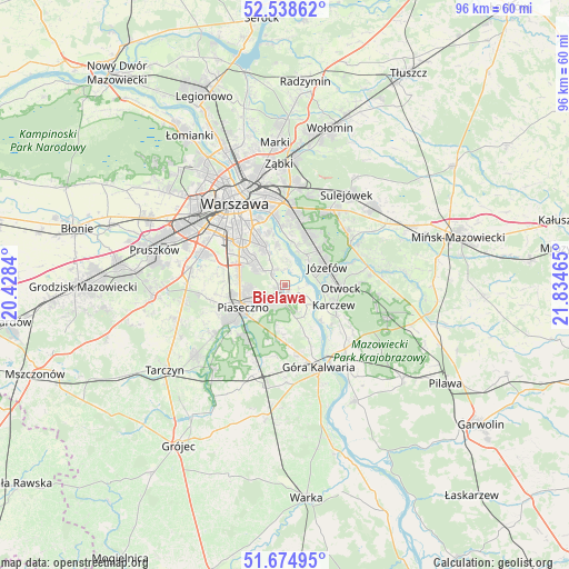
Bielawa GPS coordinates[2]
52° 6' 31.968" North, 21° 7' 53.472" East
| Map corner | latitude | longitude |
|---|---|---|
| Upper-left | 52.53862°, | 20.4284° |
| Center: | 52.10888°, | 21.13152° |
| Lower-right: | 51.67495°, | 21.83465° |
| Map W x H: | 96×96 km | = 59.7×59.7mi |
| max Lat: | 54.83135° ⇑31.9% North |
| Bielawa: | 52.10888° |
| min Lat: | ⇓68.1% South 49.21328° |
| min Long | Bielawa | max Long |
| 14.20249° | 21.13152° | 24.03723° |
| W 74.8%⇐ | ⇒25.2% E |
Elevation
Elevation of Bielawa is 87 m = 285 ft, and this is 104.4 m = 343 ft below average elevation for this country.
| Max E: |
974 m = 3196 ft | 86.1% |
| Avg. | 191.4 m = 628 ft | |
| Bielawa | 87 m = 285 ft | |
Min E: |
-3 m = -10 ft | 13.9% |
See also: Poland elevation on elevation.city.
Geographical zone
Bielawa is located in North temperate zone (between Tropic of Cancer and the Arctic Circle). Distance of this North polar circle is 1607.2 km =998.7 mi to North.| Distance of | km | miles | from Bielawa |
|---|---|---|---|
| North Pole | 4213.1 | 2617.9 | to North |
| Arctic Circle | 1607.2 | 998.7 | to North |
| Tropic Cancer | 3188 | 1980.9 | to South |
| Equator | 5794 | 3600.2 | to South |


Nearby cities:
15 places around Bielawa: (largest is in red/bold)
• Chylice
5.8 km =3.6 mi,  234°
234°
• Chyliczki
5 km =3.1 mi,  237°
237°
• Czarnów
6.3 km =3.9 mi,  201°
201°
• Józefosław
5.9 km =3.7 mi,  260°
260°
• Józefów
7.8 km =4.8 mi,  66°
66°
• Kabaty
4.2 km =2.6 mi,  304°
304°
• Karczew
8.8 km =5.5 mi,  114°
114°
• Konstancin-Jeziorna
1.9 km =1.2 mi,  209°
209°
• Mysiadło
7.8 km =4.8 mi, 264°
• Nowa Iwiczna
8.9 km =5.5 mi, 257°
• Otwock
8.9 km =5.5 mi,  92°
92°
• Piaseczno
8 km =5 mi,  247°
247°
• Ursynów
7.2 km =4.5 mi,  309°
309°
• Wilanów
6.7 km =4.2 mi,  333°
333°
• Żabieniec
8 km =5 mi, 225°
Sources, notices
• [Note1] Compared only with cities in Poland existing in our database
• [Src1] Map data: © OpenStreetMap contributors (CC-BY-SA)
• [Src2] Other city data from geonames.org with taken over terms of usage.
• [Src3] Geographical zone / Annual Mean Temperature by Robert A. Rohde @ Wikipedia
