Candelaria Arenas geodata
Candelaria Arenas (Toa Baja) is a populated place; located in Puerto Rico in America/Puerto_Rico (GMT-4) time zone. With population of 5,854 people, there are 59 cities with bigger population in this country. Compared to other cities in Puerto Rico, 79.6% of cities are located further ↓South; 61.8% of cities are located further ←West and 55.1% of cities have higher elevation than Candelaria Arenas. Note1


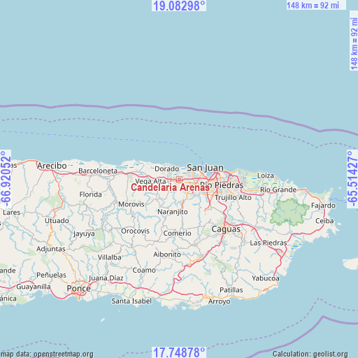
Candelaria Arenas GPS coordinates[2]
18° 25' 1.812" North, 66° 13' 2.604" West
| Map corner | latitude | longitude |
|---|---|---|
| Upper-left | 19.08298°, | -66.92052° |
| Center: | 18.41717°, | -66.21739° |
| Lower-right: | 17.74878°, | -65.51427° |
| Map W x H: | 148.3×148.4 km | = 92.1×92.2mi |
| max Lat: | 18.50078° ⇑20.4% North |
| Candelaria Arenas: | 18.41717° |
| min Lat: | ⇓79.6% South 17.95358° |
| min Long | Candelaria Aren | max Long |
| -67.2499° | -66.21739° | -65.30099° |
| W 61.8%⇐ | ⇒38.2% E |
Elevation
Elevation of Candelaria Arenas is 36 m = 118 ft, and this is 64.5 m = 212 ft below average elevation for this country.
| Max E: |
655 m = 2149 ft | 55.1% |
| Avg. | 100.5 m = 330 ft | |
| Candelaria Arenas | 36 m = 118 ft | |
Min E: |
1 m = 3 ft | 44.9% |
See also: Puerto Rico elevation on elevation.city.
Geographical zone
Candelaria Arenas is located in North Torrid zone (between Equator and Tropic of Cancer). Distance of this Northern Tropic circle is 558.1 km =346.8 mi to North.| Distance of | km | miles | from Candelaria Arenas |
|---|---|---|---|
| North Pole | 7959.3 | 4945.7 | to North |
| Arctic Circle | 5353.4 | 3326.4 | to North |
| Tropic Cancer | 558.1 | 346.8 | to North |
| Equator | 2047.8 | 1272.4 | to South |


Nearby cities:
15 places around Candelaria Arenas: (largest is in red/bold)
• Bayamón
6.8 km =4.2 mi,  107°
107°
• Campanilla
2.1 km =1.3 mi,  282°
282°
• Candelaria
1.7 km =1.1 mi,  147°
147°
• Dorado
7 km =4.3 mi,  311°
311°
• Galateo
7.5 km =4.7 mi,  215°
215°
• H. Rivera Colon
9.7 km =6 mi, 217°
• Ingenio
2.9 km =1.8 mi,  341°
341°
• Levittown
5.3 km =3.3 mi,  46°
46°
• Mucarabones
2.9 km =1.8 mi,  177°
177°
• Pájaros
5.4 km =3.4 mi, 179°
• Río Lajas
5.9 km =3.7 mi,  244°
244°
• Sabana Seca
3.6 km =2.2 mi,  72°
72°
• San José
4.6 km =2.9 mi, 242°
• Toa Alta
4.6 km =2.9 mi,  225°
225°
• Toa Baja
5.4 km =3.4 mi,  303°
303°
Sources, notices
• [Note1] Compared only with cities in Puerto Rico existing in our database
• [Src1] Map data: © OpenStreetMap contributors (CC-BY-SA)
• [Src2] Other city data from geonames.org with taken over terms of usage.
• [Src3] Geographical zone / Annual Mean Temperature by Robert A. Rohde @ Wikipedia
