Río Lajas geodata
Río Lajas (Dorado) is a populated place; located in Puerto Rico in America/Puerto_Rico (GMT-4) time zone. With population of 2,349 people, there are 121 cities with bigger population in this country. Compared to other cities in Puerto Rico, 76% of cities are located further ↓South; 54.2% of cities are located further ←West and 76.4% of cities have lower elevation than Río Lajas. Note1


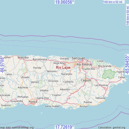
Río Lajas GPS coordinates[2]
18° 23' 40.812" North, 66° 16' 3.612" West
| Map corner | latitude | longitude |
|---|---|---|
| Upper-left | 19.06056°, | -66.9708° |
| Center: | 18.39467°, | -66.26767° |
| Lower-right: | 17.72619°, | -65.56455° |
| Map W x H: | 148.4×148.4 km | = 92.2×92.2mi |
| max Lat: | 18.50078° ⇑24% North |
| Río Lajas: | 18.39467° |
| min Lat: | ⇓76% South 17.95358° |
| min Long | Río Lajas | max Long |
| -67.2499° | -66.26767° | -65.30099° |
| W 54.2%⇐ | ⇒45.8% E |
Elevation
Elevation of Río Lajas is 136 m = 446 ft, and this is 35.5 m = 116 ft above average elevation for this country.
| Max E: |
655 m = 2149 ft | 23.6% |
| Río Lajas | 136 m 446 ft | |
| Avg. | 100.5 m = 330 ft | |
Min E: |
1 m = 3 ft | 76.4% |
See also: Puerto Rico elevation on elevation.city.
Geographical zone
Río Lajas is located in North Torrid zone (between Equator and Tropic of Cancer). Distance of this Northern Tropic circle is 560.6 km =348.3 mi to North.| Distance of | km | miles | from Río Lajas |
|---|---|---|---|
| North Pole | 7961.8 | 4947.2 | to North |
| Arctic Circle | 5355.9 | 3328 | to North |
| Tropic Cancer | 560.6 | 348.3 | to North |
| Equator | 2045.3 | 1270.9 | to South |


Nearby cities:
15 places around Río Lajas: (largest is in red/bold)
• Campanilla
4.4 km =2.7 mi,  47°
47°
• Candelaria
6.3 km =3.9 mi,  80°
80°
• Candelaria Arenas
5.9 km =3.7 mi,  64°
64°
• Corozal
7.9 km =4.9 mi,  221°
221°
• Dorado
7.1 km =4.4 mi,  0°
0°
• Galateo
3.7 km =2.3 mi,  165°
165°
• H. Rivera Colon
5.3 km =3.3 mi,  187°
187°
• Ingenio
6.9 km =4.3 mi,  39°
39°
• Mucarabones
5.5 km =3.4 mi,  94°
94°
• Pájaros
6.1 km =3.8 mi,  118°
118°
• San Antonio
7.1 km =4.4 mi,  328°
328°
• San José
1.3 km =0.8 mi,  72°
72°
• Toa Alta
2.2 km =1.4 mi,  109°
109°
• Toa Baja
5.5 km =3.4 mi,  8°
8°
• Vega Alta
7 km =4.3 mi,  286°
286°
Sources, notices
• [Note1] Compared only with cities in Puerto Rico existing in our database
• [Src1] Map data: © OpenStreetMap contributors (CC-BY-SA)
• [Src2] Other city data from geonames.org with taken over terms of usage.
• [Src3] Geographical zone / Annual Mean Temperature by Robert A. Rohde @ Wikipedia
