Pájaros geodata
Pájaros (Toa Alta) is a populated place; located in Puerto Rico in America/Puerto_Rico (GMT-4) time zone. With population of 9,466 people, there are 32 cities with bigger population in this country. Compared to other cities in Puerto Rico, 68.9% of cities are located further ↓South; 62.2% of cities are located further ←West and 52.9% of cities have lower elevation than Pájaros. Note1


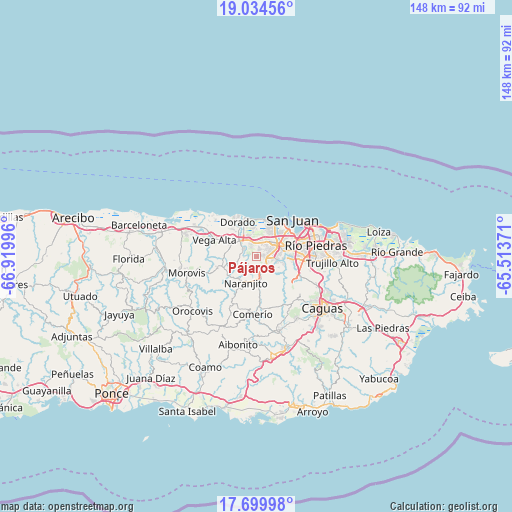
Pájaros GPS coordinates[2]
18° 22' 6.816" North, 66° 13' 0.588" West
| Map corner | latitude | longitude |
|---|---|---|
| Upper-left | 19.03456°, | -66.91996° |
| Center: | 18.36856°, | -66.21683° |
| Lower-right: | 17.69998°, | -65.51371° |
| Map W x H: | 148.4×148.4 km | = 92.2×92.2mi |
| max Lat: | 18.50078° ⇑31.1% North |
| Pájaros: | 18.36856° |
| min Lat: | ⇓68.9% South 17.95358° |
| min Long | Pájaros | max Long |
| -67.2499° | -66.21683° | -65.30099° |
| W 62.2%⇐ | ⇒37.8% E |
Elevation
Elevation of Pájaros is 53 m = 174 ft, and this is 47.5 m = 156 ft below average elevation for this country.
| Max E: |
655 m = 2149 ft | 47.1% |
| Avg. | 100.5 m = 330 ft | |
| Pájaros | 53 m = 174 ft | |
Min E: |
1 m = 3 ft | 52.9% |
See also: Puerto Rico elevation on elevation.city.
Geographical zone
Pájaros is located in North Torrid zone (between Equator and Tropic of Cancer). Distance of this Northern Tropic circle is 563.5 km =350.1 mi to North.| Distance of | km | miles | from Pájaros |
|---|---|---|---|
| North Pole | 7964.7 | 4949 | to North |
| Arctic Circle | 5358.8 | 3329.8 | to North |
| Tropic Cancer | 563.5 | 350.1 | to North |
| Equator | 2042.4 | 1269.1 | to South |


Nearby cities:
15 places around Pájaros: (largest is in red/bold)
• Bayamón
7.3 km =4.5 mi,  62°
62°
• Campanilla
6.2 km =3.9 mi,  340°
340°
• Candelaria
4 km =2.5 mi,  12°
12°
• Candelaria Arenas
5.4 km =3.4 mi,  359°
359°
• Galateo
4.5 km =2.8 mi,  261°
261°
• H. Rivera Colon
6.4 km =4 mi,  248°
248°
• Ingenio
8.2 km =5.1 mi,  353°
353°
• Levittown
9.8 km =6.1 mi,  22°
22°
• Mucarabones
2.5 km =1.6 mi,  2°
2°
• Naranjito
8.1 km =5 mi,  201°
201°
• Río Lajas
6.1 km =3.8 mi,  298°
298°
• Sabana Seca
7.3 km =4.5 mi,  27°
27°
• San José
5.3 km =3.3 mi,  308°
308°
• Toa Alta
4 km =2.5 mi, 303°
• Toa Baja
9.5 km =5.9 mi,  331°
331°
Sources, notices
• [Note1] Compared only with cities in Puerto Rico existing in our database
• [Src1] Map data: © OpenStreetMap contributors (CC-BY-SA)
• [Src2] Other city data from geonames.org with taken over terms of usage.
• [Src3] Geographical zone / Annual Mean Temperature by Robert A. Rohde @ Wikipedia
