Coto Norte geodata
Coto Norte (Vega Baja) is a populated place; located in Puerto Rico in America/Puerto_Rico (GMT-4) time zone. With population of 1,381 people, there are 184 cities with bigger population in this country. Compared to other cities in Puerto Rico, 84% of cities are located further ↓South; 58.2% of cities are located further →East and 64.9% of cities have lower elevation than Coto Norte. Note1


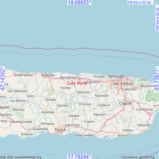
Coto Norte GPS coordinates[2]
18° 25' 50.808" North, 66° 26' 23.604" West
| Map corner | latitude | longitude |
|---|---|---|
| Upper-left | 19.09653°, | -67.14302° |
| Center: | 18.43078°, | -66.43989° |
| Lower-right: | 17.76244°, | -65.73677° |
| Map W x H: | 148.3×148.3 km | = 92.1×92.1mi |
| max Lat: | 18.50078° ⇑16% North |
| Coto Norte: | 18.43078° |
| min Lat: | ⇓84% South 17.95358° |
| min Long | Coto Norte | max Long |
| -67.2499° | -66.43989° | -65.30099° |
| W 41.8%⇐ | ⇒58.2% E |
Elevation
Elevation of Coto Norte is 81 m = 266 ft, and this is 19.5 m = 64 ft below average elevation for this country.
| Max E: |
655 m = 2149 ft | 35.1% |
| Avg. | 100.5 m = 330 ft | |
| Coto Norte | 81 m = 266 ft | |
Min E: |
1 m = 3 ft | 64.9% |
See also: Puerto Rico elevation on elevation.city.
Geographical zone
Coto Norte is located in North Torrid zone (between Equator and Tropic of Cancer). Distance of this Northern Tropic circle is 556.6 km =345.9 mi to North.| Distance of | km | miles | from Coto Norte |
|---|---|---|---|
| North Pole | 7957.8 | 4944.7 | to North |
| Arctic Circle | 5351.9 | 3325.5 | to North |
| Tropic Cancer | 556.6 | 345.9 | to North |
| Equator | 2049.3 | 1273.4 | to South |


Nearby cities:
15 places around Coto Norte: (largest is in red/bold)
• Barahona
8.9 km =5.5 mi,  183°
183°
• Barceloneta
10.6 km =6.6 mi,  281°
281°
• Brenas
11.2 km =7 mi,  68°
68°
• Ceiba
9.6 km =6 mi,  79°
79°
• Ciales
11 km =6.8 mi,  196°
196°
• Franquez
10.2 km =6.3 mi,  172°
172°
• Imbery
11.9 km =7.4 mi,  273°
273°
• La Luisa
7.7 km =4.8 mi,  285°
285°
• Manatí
5.5 km =3.4 mi, 266°
• Miranda
7.7 km =4.8 mi,  129°
129°
• Monserrate
8.5 km =5.3 mi,  85°
85°
• Sabana
9.2 km =5.7 mi, 68°
• Tierras Nuevas Poniente
6.2 km =3.9 mi,  304°
304°
• Vega Alta
11.6 km =7.2 mi,  100°
100°
• Vega Baja
5.7 km =3.5 mi, 74°
Sources, notices
• [Note1] Compared only with cities in Puerto Rico existing in our database
• [Src1] Map data: © OpenStreetMap contributors (CC-BY-SA)
• [Src2] Other city data from geonames.org with taken over terms of usage.
• [Src3] Geographical zone / Annual Mean Temperature by Robert A. Rohde @ Wikipedia
