Luyando geodata
Luyando (Aguada) is a populated place; located in Puerto Rico in America/Puerto_Rico (GMT-4) time zone. With population of 3,553 people, there are 91 cities with bigger population in this country. Compared to other cities in Puerto Rico, 68% of cities are located further ↓South; 96.9% of cities are located further →East and 54.2% of cities have higher elevation than Luyando. Note1


Luyando GPS coordinates[2]
18° 21' 51.804" North, 67° 9' 26.64" West
| Map corner | latitude | longitude |
|---|---|---|
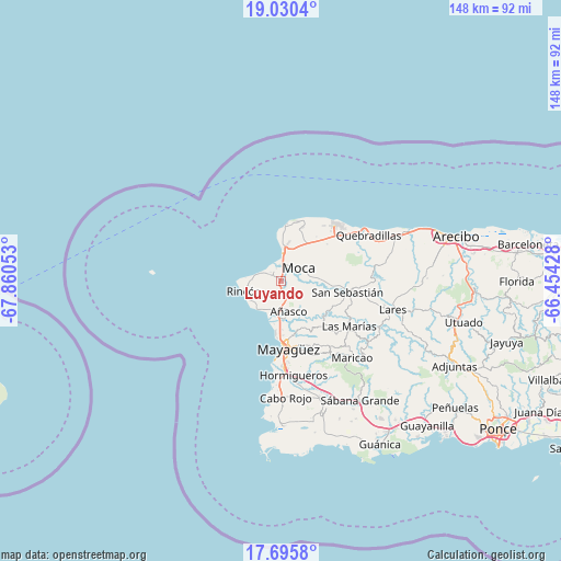
| Upper-left | 19.0304°, | -67.86053° |
| Center: | 18.36439°, | -67.1574° |
| Lower-right: | 17.6958°, | -66.45428° |
| Map W x H: | 148.4×148.4 km | = 92.2×92.2mi |
| max Lat: | 18.50078° ⇑32% North |
| Luyando: | 18.36439° |
| min Lat: | ⇓68% South 17.95358° |
| min Long | Luyando | max Long |
| -67.2499° | -67.1574° | -65.30099° |
| W 3.1%⇐ | ⇒96.9% E |
Elevation
Elevation of Luyando is 39 m = 128 ft, and this is 61.5 m = 202 ft below average elevation for this country.
| Max E: |
655 m = 2149 ft | 54.2% |
| Avg. | 100.5 m = 330 ft | |
| Luyando | 39 m = 128 ft | |
Min E: |
1 m = 3 ft | 45.8% |
See also: Puerto Rico elevation on elevation.city.
Geographical zone
Luyando is located in North Torrid zone (between Equator and Tropic of Cancer). Distance of this Northern Tropic circle is 564 km =350.5 mi to North.| Distance of | km | miles | from Luyando |
|---|---|---|---|
| North Pole | 7965.1 | 4949.3 | to North |
| Arctic Circle | 5359.2 | 3330.1 | to North |
| Tropic Cancer | 564 | 350.5 | to North |
| Equator | 2041.9 | 1268.8 | to South |


Nearby cities:
15 places around Luyando: (largest is in red/bold)
• Aceitunas
13.1 km =8.1 mi,  48°
48°
• Aguada
3.7 km =2.3 mi,  297°
297°
• Aguadilla
7 km =4.3 mi,  2°
2°
• Añasco
9.3 km =5.8 mi,  168°
168°
• Caban
9.1 km =5.7 mi,  14°
14°
• Espino
10.6 km =6.6 mi,  157°
157°
• Hato Arriba
13.1 km =8.1 mi,  94°
94°
• La Playa
9.1 km =5.7 mi,  199°
199°
• Las Marias
8 km =5 mi, 171°
• Moca
5.7 km =3.5 mi, 54°
• Mora
17.1 km =10.6 mi, 50°
• Rafael Hernandez
14.5 km =9 mi,  34°
34°
• Rincón
10.1 km =6.3 mi,  254°
254°
• San Antonio
15.5 km =9.6 mi,  23°
23°
• Stella
10.6 km =6.6 mi,  243°
243°
Sources, notices
• [Note1] Compared only with cities in Puerto Rico existing in our database
• [Src1] Map data: © OpenStreetMap contributors (CC-BY-SA)
• [Src2] Other city data from geonames.org with taken over terms of usage.
• [Src3] Geographical zone / Annual Mean Temperature by Robert A. Rohde @ Wikipedia
