Rafael Hernandez geodata
Rafael Hernandez (Aguadilla) is a populated place; located in Puerto Rico in America/Puerto_Rico (GMT-4) time zone. With population of 1,516 people, there are 172 cities with bigger population in this country. Compared to other cities in Puerto Rico, 96.9% of cities are located further ↓South; 90.7% of cities are located further →East and 72.9% of cities have lower elevation than Rafael Hernandez. Note1


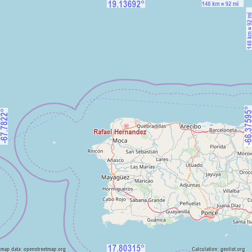
Rafael Hernandez GPS coordinates[2]
18° 28' 16.788" North, 67° 4' 44.652" West
| Map corner | latitude | longitude |
|---|---|---|
| Upper-left | 19.13692°, | -67.7822° |
| Center: | 18.47133°, | -67.07907° |
| Lower-right: | 17.80315°, | -66.37595° |
| Map W x H: | 148.3×148.3 km | = 92.1×92.1mi |
| max Lat: | 18.50078° ⇑3.1% North |
| Rafael Hernandez: | 18.47133° |
| min Lat: | ⇓96.9% South 17.95358° |
| min Long | Rafael Hernande | max Long |
| -67.2499° | -67.07907° | -65.30099° |
| W 9.3%⇐ | ⇒90.7% E |
Elevation
Elevation of Rafael Hernandez is 109 m = 358 ft, and this is 8.5 m = 28 ft above average elevation for this country.
| Max E: |
655 m = 2149 ft | 27.1% |
| Rafael Hernandez | 109 m 358 ft | |
| Avg. | 100.5 m = 330 ft | |
Min E: |
1 m = 3 ft | 72.9% |
See also: Puerto Rico elevation on elevation.city.
Geographical zone
Rafael Hernandez is located in North Torrid zone (between Equator and Tropic of Cancer). Distance of this Northern Tropic circle is 552.1 km =343.1 mi to North.| Distance of | km | miles | from Rafael Hernandez |
|---|---|---|---|
| North Pole | 7953.2 | 4941.9 | to North |
| Arctic Circle | 5347.4 | 3322.7 | to North |
| Tropic Cancer | 552.1 | 343.1 | to North |
| Equator | 2053.8 | 1276.2 | to South |


Nearby cities:
15 places around Rafael Hernandez: (largest is in red/bold)
• Aceitunas
3.5 km =2.2 mi,  154°
154°
• Aguada
15.4 km =9.6 mi,  228°
228°
• Aguadilla
9.3 km =5.8 mi,  238°
238°
• Caban
6.8 km =4.2 mi, 242°
• Cacao
15.5 km =9.6 mi,  104°
104°
• Hato Arriba
13.7 km =8.5 mi,  159°
159°
• Isabela
6.6 km =4.1 mi,  60°
60°
• Luyando
14.5 km =9 mi,  214°
214°
• Moca
9.3 km =5.8 mi,  202°
202°
• Mora
5 km =3.1 mi, 100°
• Piedra Gorda
20.6 km =12.8 mi, 101°
• Quebradillas
14.8 km =9.2 mi,  88°
88°
• San Antonio
3.1 km =1.9 mi,  318°
318°
• San Antonio
13.8 km =8.6 mi, 99°
• San Sebastián
17.7 km =11 mi, 147°
Sources, notices
• [Note1] Compared only with cities in Puerto Rico existing in our database
• [Src1] Map data: © OpenStreetMap contributors (CC-BY-SA)
• [Src2] Other city data from geonames.org with taken over terms of usage.
• [Src3] Geographical zone / Annual Mean Temperature by Robert A. Rohde @ Wikipedia
