San Antonio geodata
San Antonio (Aguadilla) is a populated place; located in Puerto Rico in America/Puerto_Rico (GMT-4) time zone. With population of 2,300 people, there are 125 cities with bigger population in this country. Compared to other cities in Puerto Rico, 99.6% of cities are located further ↓South; 91.6% of cities are located further →East and 59.6% of cities have lower elevation than San Antonio. Note1


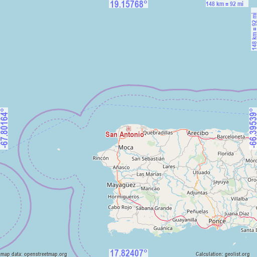
San Antonio GPS coordinates[2]
18° 29' 31.812" North, 67° 5' 54.636" West
| Map corner | latitude | longitude |
|---|---|---|
| Upper-left | 19.15768°, | -67.80164° |
| Center: | 18.49217°, | -67.09851° |
| Lower-right: | 17.82407°, | -66.39539° |
| Map W x H: | 148.3×148.3 km | = 92.1×92.1mi |
| max Lat: | 18.50078° ⇑0.4% North |
| San Antonio: | 18.49217° |
| min Lat: | ⇓99.6% South 17.95358° |
| min Long | San Antonio | max Long |
| -67.2499° | -67.09851° | -65.30099° |
| W 8.4%⇐ | ⇒91.6% E |
Elevation
Elevation of San Antonio is 69 m = 226 ft, and this is 31.5 m = 103 ft below average elevation for this country.
| Max E: |
655 m = 2149 ft | 40.4% |
| Avg. | 100.5 m = 330 ft | |
| San Antonio | 69 m = 226 ft | |
Min E: |
1 m = 3 ft | 59.6% |
See also: Puerto Rico elevation on elevation.city.
Geographical zone
San Antonio is located in North Torrid zone (between Equator and Tropic of Cancer). Distance of this Northern Tropic circle is 549.8 km =341.6 mi to North.| Distance of | km | miles | from San Antonio |
|---|---|---|---|
| North Pole | 7950.9 | 4940.5 | to North |
| Arctic Circle | 5345 | 3321.2 | to North |
| Tropic Cancer | 549.8 | 341.6 | to North |
| Equator | 2056.1 | 1277.6 | to South |


Nearby cities:
15 places around San Antonio: (largest is in red/bold)
• Aceitunas
6.5 km =4 mi,  146°
146°
• Aguada
15.7 km =9.8 mi,  217°
217°
• Aguadilla
9.3 km =5.8 mi, 219°
• Caban
6.7 km =4.2 mi, 216°
• Cacao
18.1 km =11.2 mi,  109°
109°
• Hato Arriba
16.6 km =10.3 mi,  155°
155°
• Isabela
7.9 km =4.9 mi,  83°
83°
• Las Marias
22.7 km =14.1 mi,  192°
192°
• Luyando
15.5 km =9.6 mi,  203°
203°
• Moca
11 km =6.8 mi, 188°
• Mora
7.7 km =4.8 mi,  115°
115°
• Quebradillas
17 km =10.6 mi,  96°
96°
• Rafael Hernandez
3.1 km =1.9 mi,  138°
138°
• San Antonio
16.3 km =10.1 mi, 106°
• San Sebastián
20.7 km =12.9 mi, 146°
Sources, notices
• [Note1] Compared only with cities in Puerto Rico existing in our database
• [Src1] Map data: © OpenStreetMap contributors (CC-BY-SA)
• [Src2] Other city data from geonames.org with taken over terms of usage.
• [Src3] Geographical zone / Annual Mean Temperature by Robert A. Rohde @ Wikipedia
