Parcelas La Milagrosa geodata
Parcelas La Milagrosa (Cidra) is a populated place; located in Puerto Rico in America/Puerto_Rico (GMT-4) time zone. With population of 1,344 people, there are 186 cities with bigger population in this country. Compared to other cities in Puerto Rico, 60.9% of cities are located further ↑North; 64% of cities are located further ←West and 98.2% of cities have lower elevation than Parcelas La Milagrosa. Note1


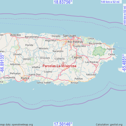
Parcelas La Milagrosa GPS coordinates[2]
18° 10' 14.844" North, 66° 11' 17.592" West
| Map corner | latitude | longitude |
|---|---|---|
| Upper-left | 18.83756°, | -66.89135° |
| Center: | 18.17079°, | -66.18822° |
| Lower-right: | 17.50146°, | -65.4851° |
| Map W x H: | 148.6×148.6 km | = 92.3×92.3mi |
| max Lat: | 18.50078° ⇑60.9% North |
| Parcelas La Milagrosa: | 18.17079° |
| min Lat: | ⇓39.1% South 17.95358° |
| min Long | Parcelas La Mil | max Long |
| -67.2499° | -66.18822° | -65.30099° |
| W 64%⇐ | ⇒36% E |
Elevation
Elevation of Parcelas La Milagrosa is 552 m = 1811 ft, and this is 451.5 m = 1481 ft above average elevation for this country.
| Max E: |
655 m = 2149 ft | 1.8% |
| Parcelas La Milagrosa | 552 m 1811 ft | |
| Avg. | 100.5 m = 330 ft | |
Min E: |
1 m = 3 ft | 98.2% |
See also: Puerto Rico elevation on elevation.city.
Geographical zone
Parcelas La Milagrosa is located in North Torrid zone (between Equator and Tropic of Cancer). Distance of this Northern Tropic circle is 585.5 km =363.8 mi to North.| Distance of | km | miles | from Parcelas La Milagrosa |
|---|---|---|---|
| North Pole | 7986.7 | 4962.7 | to North |
| Arctic Circle | 5380.8 | 3343.5 | to North |
| Tropic Cancer | 585.5 | 363.8 | to North |
| Equator | 2020.4 | 1255.4 | to South |


Nearby cities:
15 places around Parcelas La Milagrosa: (largest is in red/bold)
• Aguas Buenas
13.1 km =8.1 mi,  43°
43°
• Aibonito
8.9 km =5.5 mi,  247°
247°
• Barranquitas
12.6 km =7.8 mi,  278°
278°
• Bayamon
8 km =5 mi,  84°
84°
• Cayey
7 km =4.3 mi,  160°
160°
• Cidra
2.9 km =1.8 mi, 78°
• Comerío
6.6 km =4.1 mi,  322°
322°
• G. L. Garcia
10.1 km =6.3 mi,  118°
118°
• La Plena
13.9 km =8.6 mi,  187°
187°
• Palomas
9.9 km =6.2 mi,  313°
313°
• Parcelas Nuevas
3.8 km =2.4 mi,  153°
153°
• Pastos
9.5 km =5.9 mi,  231°
231°
• Santa Clara
8.2 km =5.1 mi,  49°
49°
• Sumidero
8.2 km =5.1 mi, 49°
• Vázquez
12.8 km =8 mi,  204°
204°
Sources, notices
• [Note1] Compared only with cities in Puerto Rico existing in our database
• [Src1] Map data: © OpenStreetMap contributors (CC-BY-SA)
• [Src2] Other city data from geonames.org with taken over terms of usage.
• [Src3] Geographical zone / Annual Mean Temperature by Robert A. Rohde @ Wikipedia
