Pueblito del Rio geodata
Pueblito del Rio (Las Piedras) is a populated place; located in Puerto Rico in America/Puerto_Rico (GMT-4) time zone. With population of 1,481 people, there are 176 cities with bigger population in this country. Compared to other cities in Puerto Rico, 51.6% of cities are located further ↑North; 86.2% of cities are located further ←West and 65.8% of cities have lower elevation than Pueblito del Rio. Note1


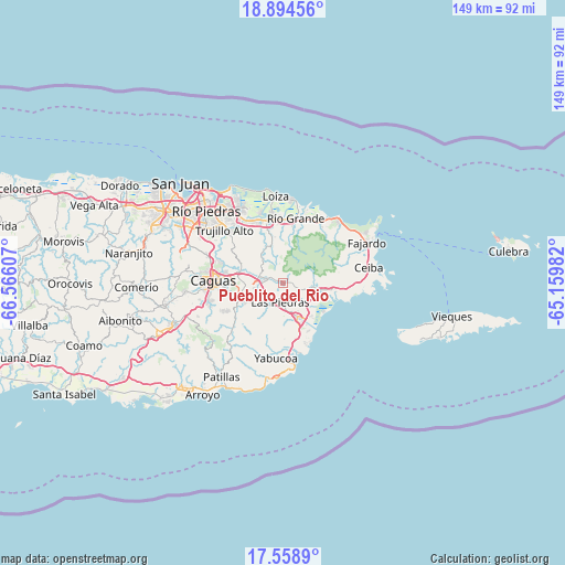
Pueblito del Rio GPS coordinates[2]
18° 13' 40.836" North, 65° 51' 46.584" West
| Map corner | latitude | longitude |
|---|---|---|
| Upper-left | 18.89456°, | -66.56607° |
| Center: | 18.22801°, | -65.86294° |
| Lower-right: | 17.5589°, | -65.15982° |
| Map W x H: | 148.5×148.5 km | = 92.3×92.3mi |
| max Lat: | 18.50078° ⇑51.6% North |
| Pueblito del Rio: | 18.22801° |
| min Lat: | ⇓48.4% South 17.95358° |
| min Long | Pueblito del Ri | max Long |
| -67.2499° | -65.86294° | -65.30099° |
| W 86.2%⇐ | ⇒13.8% E |
Elevation
Elevation of Pueblito del Rio is 83 m = 272 ft, and this is 17.5 m = 57 ft below average elevation for this country.
| Max E: |
655 m = 2149 ft | 34.2% |
| Avg. | 100.5 m = 330 ft | |
| Pueblito del Rio | 83 m = 272 ft | |
Min E: |
1 m = 3 ft | 65.8% |
See also: Puerto Rico elevation on elevation.city.
Geographical zone
Pueblito del Rio is located in North Torrid zone (between Equator and Tropic of Cancer). Distance of this Northern Tropic circle is 579.2 km =359.9 mi to North.| Distance of | km | miles | from Pueblito del Rio |
|---|---|---|---|
| North Pole | 7980.3 | 4958.7 | to North |
| Arctic Circle | 5374.4 | 3339.5 | to North |
| Tropic Cancer | 579.2 | 359.9 | to North |
| Equator | 2026.8 | 1259.4 | to South |


Nearby cities:
15 places around Pueblito del Rio: (largest is in red/bold)
• Antón Ruiz
7.5 km =4.7 mi,  129°
129°
• Bajandas
11.6 km =7.2 mi, 132°
• Benitez
5.3 km =3.3 mi,  341°
341°
• Boqueron
2.7 km =1.7 mi,  146°
146°
• Celada
11.9 km =7.4 mi,  294°
294°
• El Mangó
1.9 km =1.2 mi, 291°
• Gurabo
12 km =7.5 mi,  284°
284°
• Humacao
9.5 km =5.9 mi,  156°
156°
• Juncos
6.1 km =3.8 mi,  269°
269°
• La Fermina
5.9 km =3.7 mi,  170°
170°
• Las Piedras
5 km =3.1 mi,  184°
184°
• Lomas
6.6 km =4.1 mi,  312°
312°
• Peña Pobre
4.5 km =2.8 mi,  107°
107°
• Río Blanco
7.9 km =4.9 mi,  97°
97°
• San Lorenzo
11.2 km =7 mi,  247°
247°
Sources, notices
• [Note1] Compared only with cities in Puerto Rico existing in our database
• [Src1] Map data: © OpenStreetMap contributors (CC-BY-SA)
• [Src2] Other city data from geonames.org with taken over terms of usage.
• [Src3] Geographical zone / Annual Mean Temperature by Robert A. Rohde @ Wikipedia
