Celada geodata
Celada (Gurabo) is a populated place; located in Puerto Rico in America/Puerto_Rico (GMT-4) time zone. With population of 4,435 people, there are 78 cities with bigger population in this country. Compared to other cities in Puerto Rico, 54.2% of cities are located further ↓South; 77.3% of cities are located further ←West and 66.7% of cities have lower elevation than Celada. Note1


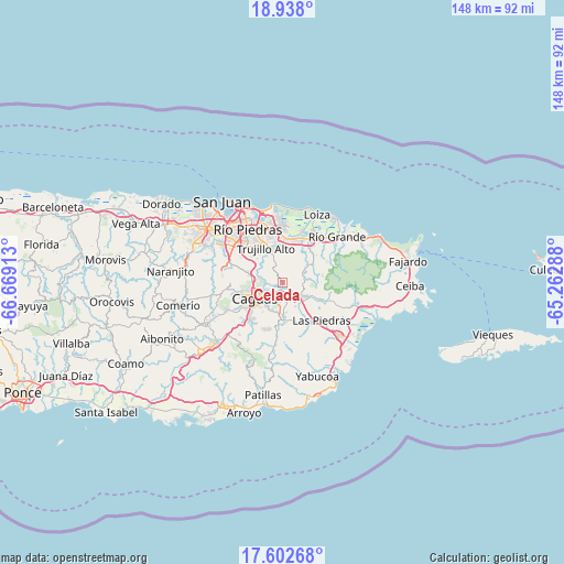
Celada GPS coordinates[2]
18° 16' 17.832" North, 65° 57' 57.6" West
| Map corner | latitude | longitude |
|---|---|---|
| Upper-left | 18.938°, | -66.66913° |
| Center: | 18.27162°, | -65.966° |
| Lower-right: | 17.60268°, | -65.26288° |
| Map W x H: | 148.5×148.5 km | = 92.3×92.3mi |
| max Lat: | 18.50078° ⇑45.8% North |
| Celada: | 18.27162° |
| min Lat: | ⇓54.2% South 17.95358° |
| min Long | Celada | max Long |
| -67.2499° | -65.966° | -65.30099° |
| W 77.3%⇐ | ⇒22.7% E |
Elevation
Elevation of Celada is 84 m = 276 ft, and this is 16.5 m = 54 ft below average elevation for this country.
| Max E: |
655 m = 2149 ft | 33.3% |
| Avg. | 100.5 m = 330 ft | |
| Celada | 84 m = 276 ft | |
Min E: |
1 m = 3 ft | 66.7% |
See also: Puerto Rico elevation on elevation.city.
Geographical zone
Celada is located in North Torrid zone (between Equator and Tropic of Cancer). Distance of this Northern Tropic circle is 574.3 km =356.9 mi to North.| Distance of | km | miles | from Celada |
|---|---|---|---|
| North Pole | 7975.4 | 4955.7 | to North |
| Arctic Circle | 5369.6 | 3336.5 | to North |
| Tropic Cancer | 574.3 | 356.9 | to North |
| Equator | 2031.6 | 1262.4 | to South |


Nearby cities:
15 places around Celada: (largest is in red/bold)
• Bairoa
8 km =5 mi,  259°
259°
• Benitez
9.2 km =5.7 mi,  88°
88°
• Boqueron
14.3 km =8.9 mi,  119°
119°
• Caguas
9.7 km =6 mi,  244°
244°
• Campo Rico
10.2 km =6.3 mi,  44°
44°
• Canovanas
13.5 km =8.4 mi,  31°
31°
• Carolina
12.2 km =7.6 mi,  4°
4°
• El Mangó
10 km =6.2 mi,  114°
114°
• Gurabo
2.1 km =1.3 mi,  200°
200°
• Jagual
12.6 km =7.8 mi,  194°
194°
• Juncos
6.8 km =4.2 mi,  135°
135°
• Lomas
6.1 km =3.8 mi, 93°
• Pueblito del Rio
11.9 km =7.4 mi, 114°
• San Lorenzo
9.2 km =5.7 mi,  176°
176°
• Trujillo Alto
10.2 km =6.3 mi,  334°
334°
Sources, notices
• [Note1] Compared only with cities in Puerto Rico existing in our database
• [Src1] Map data: © OpenStreetMap contributors (CC-BY-SA)
• [Src2] Other city data from geonames.org with taken over terms of usage.
• [Src3] Geographical zone / Annual Mean Temperature by Robert A. Rohde @ Wikipedia
