Boqueron geodata
Boqueron (Las Piedras) is a populated place; located in Puerto Rico in America/Puerto_Rico (GMT-4) time zone. With population of 1,218 people, there are 193 cities with bigger population in this country. Compared to other cities in Puerto Rico, 56.4% of cities are located further ↑North; 88.4% of cities are located further ←West and 72% of cities have lower elevation than Boqueron. Note1


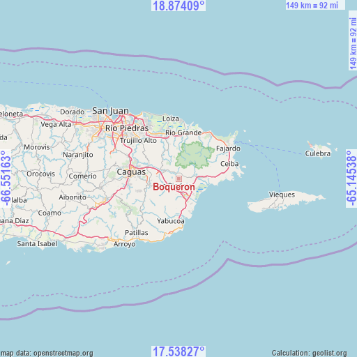
Boqueron GPS coordinates[2]
18° 12' 26.856" North, 65° 50' 54.6" West
| Map corner | latitude | longitude |
|---|---|---|
| Upper-left | 18.87409°, | -66.55163° |
| Center: | 18.20746°, | -65.8485° |
| Lower-right: | 17.53827°, | -65.14538° |
| Map W x H: | 148.5×148.5 km | = 92.3×92.3mi |
| max Lat: | 18.50078° ⇑56.4% North |
| Boqueron: | 18.20746° |
| min Lat: | ⇓43.6% South 17.95358° |
| min Long | Boqueron | max Long |
| -67.2499° | -65.8485° | -65.30099° |
| W 88.4%⇐ | ⇒11.6% E |
Elevation
Elevation of Boqueron is 102 m = 335 ft, and this is 1.5 m = 5 ft above average elevation for this country.
| Max E: |
655 m = 2149 ft | 28% |
| Boqueron | 102 m 335 ft | |
| Avg. | 100.5 m = 330 ft | |
Min E: |
1 m = 3 ft | 72% |
See also: Puerto Rico elevation on elevation.city.
Geographical zone
Boqueron is located in North Torrid zone (between Equator and Tropic of Cancer). Distance of this Northern Tropic circle is 581.4 km =361.3 mi to North.| Distance of | km | miles | from Boqueron |
|---|---|---|---|
| North Pole | 7982.6 | 4960.2 | to North |
| Arctic Circle | 5376.7 | 3340.9 | to North |
| Tropic Cancer | 581.4 | 361.3 | to North |
| Equator | 2024.5 | 1258 | to South |


Nearby cities:
15 places around Boqueron: (largest is in red/bold)
• Antón Ruiz
4.9 km =3 mi,  120°
120°
• Bajandas
9 km =5.6 mi,  128°
128°
• Benitez
8 km =5 mi,  336°
336°
• Candelero Arriba
11.8 km =7.3 mi,  174°
174°
• Duque
11.7 km =7.3 mi,  73°
73°
• El Mangó
4.4 km =2.7 mi,  312°
312°
• Humacao
6.8 km =4.2 mi,  160°
160°
• Juncos
8 km =5 mi,  286°
286°
• La Fermina
3.6 km =2.2 mi,  188°
188°
• Las Piedras
3.3 km =2.1 mi,  214°
214°
• Lomas
9.3 km =5.8 mi,  316°
316°
• Peña Pobre
2.9 km =1.8 mi, 72°
• Pueblito del Rio
2.7 km =1.7 mi,  326°
326°
• Punta Santiago
11.5 km =7.1 mi,  113°
113°
• Río Blanco
6.5 km =4 mi,  79°
79°
Sources, notices
• [Note1] Compared only with cities in Puerto Rico existing in our database
• [Src1] Map data: © OpenStreetMap contributors (CC-BY-SA)
• [Src2] Other city data from geonames.org with taken over terms of usage.
• [Src3] Geographical zone / Annual Mean Temperature by Robert A. Rohde @ Wikipedia
