La Fermina geodata
La Fermina (Las Piedras) is a populated place; located in Puerto Rico in America/Puerto_Rico (GMT-4) time zone. With population of 3,177 people, there are 100 cities with bigger population in this country. Compared to other cities in Puerto Rico, 60.4% of cities are located further ↑North; 87.1% of cities are located further ←West and 75.1% of cities have lower elevation than La Fermina. Note1


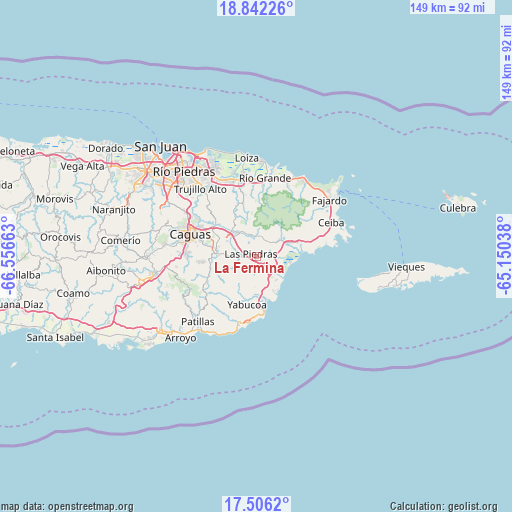
La Fermina GPS coordinates[2]
18° 10' 31.836" North, 65° 51' 12.6" West
| Map corner | latitude | longitude |
|---|---|---|
| Upper-left | 18.84226°, | -66.55663° |
| Center: | 18.17551°, | -65.8535° |
| Lower-right: | 17.5062°, | -65.15038° |
| Map W x H: | 148.6×148.6 km | = 92.3×92.3mi |
| max Lat: | 18.50078° ⇑60.4% North |
| La Fermina: | 18.17551° |
| min Lat: | ⇓39.6% South 17.95358° |
| min Long | La Fermina | max Long |
| -67.2499° | -65.8535° | -65.30099° |
| W 87.1%⇐ | ⇒12.9% E |
Elevation
Elevation of La Fermina is 130 m = 427 ft, and this is 29.5 m = 97 ft above average elevation for this country.
| Max E: |
655 m = 2149 ft | 24.9% |
| La Fermina | 130 m 427 ft | |
| Avg. | 100.5 m = 330 ft | |
Min E: |
1 m = 3 ft | 75.1% |
See also: Puerto Rico elevation on elevation.city.
Geographical zone
La Fermina is located in North Torrid zone (between Equator and Tropic of Cancer). Distance of this Northern Tropic circle is 585 km =363.5 mi to North.| Distance of | km | miles | from La Fermina |
|---|---|---|---|
| North Pole | 7986.1 | 4962.3 | to North |
| Arctic Circle | 5380.2 | 3343.1 | to North |
| Tropic Cancer | 585 | 363.5 | to North |
| Equator | 2020.9 | 1255.7 | to South |


Nearby cities:
15 places around La Fermina: (largest is in red/bold)
• Antón Ruiz
4.9 km =3 mi,  77°
77°
• Bajandas
7.9 km =4.9 mi,  104°
104°
• Benitez
11.2 km =7 mi,  346°
346°
• Boqueron
3.6 km =2.2 mi,  8°
8°
• Candelero Arriba
8.4 km =5.2 mi,  167°
167°
• Comunas
9.9 km =6.2 mi, 174°
• El Mangó
7.1 km =4.4 mi,  337°
337°
• Humacao
4 km =2.5 mi,  136°
136°
• Juncos
9.2 km =5.7 mi,  309°
309°
• Las Piedras
1.6 km =1 mi,  301°
301°
• Peña Pobre
5.5 km =3.4 mi,  36°
36°
• Pueblito del Rio
5.9 km =3.7 mi, 350°
• Punta Santiago
11.2 km =7 mi, 95°
• Río Blanco
8.4 km =5.2 mi,  55°
55°
• San Lorenzo
11.5 km =7.1 mi,  277°
277°
Sources, notices
• [Note1] Compared only with cities in Puerto Rico existing in our database
• [Src1] Map data: © OpenStreetMap contributors (CC-BY-SA)
• [Src2] Other city data from geonames.org with taken over terms of usage.
• [Src3] Geographical zone / Annual Mean Temperature by Robert A. Rohde @ Wikipedia
