Viana do Alentejo geodata
Viana do Alentejo (Évora) is a seat of a second-order administrative division; located in Portugal in Europe/Lisbon (GMT+1) time zone. In our database, there are 824 cities with bigger population. Compared to other cities in Portugal, 82% of cities are located further ↑North; 78.7% of cities are located further ←West and 76.6% of cities have lower elevation than Viana do Alentejo. Note1


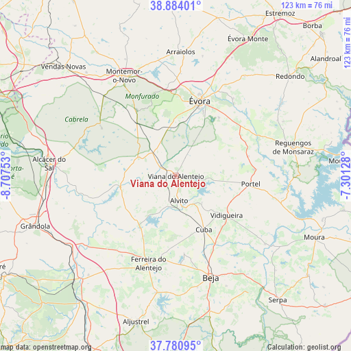
Viana do Alentejo GPS coordinates[2]
38° 20' 4.488" North, 8° 0' 15.84" West
| Map corner | latitude | longitude |
|---|---|---|
| Upper-left | 38.88401°, | -8.70753° |
| Center: | 38.33458°, | -8.0044° |
| Lower-right: | 37.78095°, | -7.30128° |
| Map W x H: | 122.6×122.6 km | = 76.2×76.2mi |
| max Lat: | 42.11337° ⇑82% North |
| Viana do Alentejo: | 38.33458° |
| min Lat: | ⇓18% South 32.6448° |
| min Long | Viana do Alente | max Long |
| -31.17847° | -8.0044° | -6.27308° |
| W 78.7%⇐ | ⇒21.3% E |
Elevation
Elevation of Viana do Alentejo is 249 m = 817 ft, and this is 72 m = 236 ft above average elevation for this country.
| Max E: |
1008 m = 3307 ft | 23.4% |
| Viana do Alentejo | 249 m 817 ft | |
| Avg. | 177 m = 581 ft | |
Min E: |
-128 m = -420 ft | 76.6% |
See also: Portugal elevation on elevation.city.
Geographical zone
Viana do Alentejo is located in North temperate zone (between Tropic of Cancer and the Arctic Circle). Distance of this Northern Tropic circle is 1656.5 km =1029.3 mi to South.| Distance of | km | miles | from Viana do Alentejo |
|---|---|---|---|
| North Pole | 5744.7 | 3569.6 | to North |
| Arctic Circle | 3138.8 | 1950.4 | to North |
| Tropic Cancer | 1656.5 | 1029.3 | to South |
| Equator | 4262.4 | 2648.5 | to South |


Nearby cities:
15 places around Viana do Alentejo: (largest is in red/bold)
• Alvito
8.8 km =5.5 mi,  172°
172°
• Beja
37.6 km =23.4 mi,  160°
160°
• Beringel
31 km =19.3 mi,  176°
176°
• Cuba
21.2 km =13.2 mi,  152°
152°
• Faro do Alentejo
21.4 km =13.3 mi, 165°
• Ferreira do Alentejo
31.7 km =19.7 mi, 184°
• Mombeja
34.7 km =21.6 mi, 184°
• Montemor-o-Novo
39.4 km =24.5 mi,  332°
332°
• Neves
38.5 km =23.9 mi, 154°
• Portel
26.5 km =16.5 mi,  96°
96°
• São Brissos
29.6 km =18.4 mi, 170°
• São Matias
28.2 km =17.5 mi, 152°
• Trigaches
27.3 km =17 mi, 174°
• Vidigueira
22.6 km =14 mi,  127°
127°
• Évora
27.4 km =17 mi,  19°
19°
Sources, notices
• [Note1] Compared only with cities in Portugal existing in our database
• [Src1] Map data: © OpenStreetMap contributors (CC-BY-SA)
• [Src2] Other city data from geonames.org with taken over terms of usage.
• [Src3] Geographical zone / Annual Mean Temperature by Robert A. Rohde @ Wikipedia
