Vale de Santarém geodata
Vale de Santarém (Santarém) is a populated place; located in Portugal in Europe/Lisbon (GMT+1) time zone. With population of 2,920 people, there are 591 cities with bigger population in this country. Compared to other cities in Portugal, 60.4% of cities are located further ↑North; 64.4% of cities are located further →East and 83.6% of cities have higher elevation than Vale de Santarém. Note1


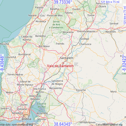
Vale de Santarém GPS coordinates[2]
39° 11' 25.872" North, 8° 43' 38.46" West
| Map corner | latitude | longitude |
|---|---|---|
| Upper-left | 39.73336°, | -9.43048° |
| Center: | 39.19052°, | -8.72735° |
| Lower-right: | 38.64345°, | -8.02423° |
| Map W x H: | 121.2×121.2 km | = 75.3×75.3mi |
| max Lat: | 42.11337° ⇑60.4% North |
| Vale de Santarém: | 39.19052° |
| min Lat: | ⇓39.6% South 32.6448° |
| min Long | Vale de Santar� | max Long |
| -31.17847° | -8.72735° | -6.27308° |
| W 35.6%⇐ | ⇒64.4% E |
Elevation
Elevation of Vale de Santarém is 26 m = 85 ft, and this is 151 m = 495 ft below average elevation for this country.
| Max E: |
1008 m = 3307 ft | 83.6% |
| Avg. | 177 m = 581 ft | |
| Vale de Santarém | 26 m = 85 ft | |
Min E: |
-128 m = -420 ft | 16.4% |
See also: Portugal elevation on elevation.city.
Geographical zone
Vale de Santarém is located in North temperate zone (between Tropic of Cancer and the Arctic Circle). Distance of this Northern Tropic circle is 1751.7 km =1088.5 mi to South.| Distance of | km | miles | from Vale de Santarém |
|---|---|---|---|
| North Pole | 5649.5 | 3510.4 | to North |
| Arctic Circle | 3043.6 | 1891.2 | to North |
| Tropic Cancer | 1751.7 | 1088.5 | to South |
| Equator | 4357.6 | 2707.7 | to South |


Nearby cities:
15 places around Vale de Santarém: (largest is in red/bold)
• Alcanhões
13.1 km =8.1 mi,  26°
26°
• Almeirim
8.9 km =5.5 mi,  77°
77°
• Alpiarça
14.6 km =9.1 mi,  59°
59°
• Aveiras de Cima
15.9 km =9.9 mi,  248°
248°
• Azambuja
18.1 km =11.2 mi,  222°
222°
• Bemfica
6.3 km =3.9 mi,  146°
146°
• Cartaxo
6.2 km =3.9 mi,  236°
236°
• Fazendas de Almeirim
13.7 km =8.5 mi,  96°
96°
• Marinhais
16.1 km =10 mi,  172°
172°
• Pontével
10.6 km =6.6 mi, 244°
• Salvaterra de Magos
19 km =11.8 mi,  197°
197°
• Santarém
6.1 km =3.8 mi,  38°
38°
• São Vicente do Paul
19.9 km =12.4 mi, 27°
• Vale de Figueira
15.4 km =9.6 mi, 33°
• Vila Chã de Ourique
3.9 km =2.4 mi, 238°
Sources, notices
• [Note1] Compared only with cities in Portugal existing in our database
• [Src1] Map data: © OpenStreetMap contributors (CC-BY-SA)
• [Src2] Other city data from geonames.org with taken over terms of usage.
• [Src3] Geographical zone / Annual Mean Temperature by Robert A. Rohde @ Wikipedia
