Póvoa e Meadas geodata
Póvoa e Meadas (Portalegre) is a seat of a third-order administrative division; located in Portugal in Europe/Lisbon (GMT+1) time zone. In our database, there are 824 cities with bigger population. Compared to other cities in Portugal, 52.4% of cities are located further ↑North; 91.6% of cities are located further ←West and 83.5% of cities have lower elevation than Póvoa e Meadas. Note1


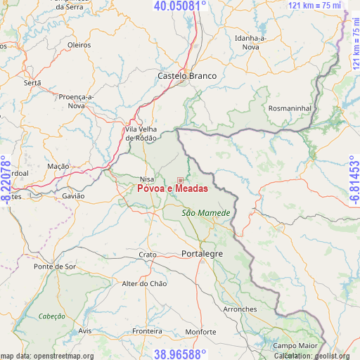
Póvoa e Meadas GPS coordinates[2]
39° 30' 37.656" North, 7° 31' 3.54" West
| Map corner | latitude | longitude |
|---|---|---|
| Upper-left | 40.05081°, | -8.22078° |
| Center: | 39.51046°, | -7.51765° |
| Lower-right: | 38.96588°, | -6.81453° |
| Map W x H: | 120.6×120.6 km | = 74.9×74.9mi |
| max Lat: | 42.11337° ⇑52.4% North |
| Póvoa e Meadas: | 39.51046° |
| min Lat: | ⇓47.6% South 32.6448° |
| min Long | Póvoa e Meadas | max Long |
| -31.17847° | -7.51765° | -6.27308° |
| W 91.6%⇐ | ⇒8.4% E |
Elevation
Elevation of Póvoa e Meadas is 335 m = 1099 ft, and this is 158 m = 518 ft above average elevation for this country.
| Max E: |
1008 m = 3307 ft | 16.5% |
| Póvoa e Meadas | 335 m 1099 ft | |
| Avg. | 177 m = 581 ft | |
Min E: |
-128 m = -420 ft | 83.5% |
See also: Portugal elevation on elevation.city.
Geographical zone
Póvoa e Meadas is located in North temperate zone (between Tropic of Cancer and the Arctic Circle). Distance of this Northern Tropic circle is 1787.2 km =1110.5 mi to South.| Distance of | km | miles | from Póvoa e Meadas |
|---|---|---|---|
| North Pole | 5613.9 | 3488.3 | to North |
| Arctic Circle | 3008 | 1869.1 | to North |
| Tropic Cancer | 1787.2 | 1110.5 | to South |
| Equator | 4393.2 | 2729.8 | to South |


Nearby cities:
15 places around Póvoa e Meadas: (largest is in red/bold)
• Alagoa
16.7 km =10.4 mi,  186°
186°
• Alegrete
34.4 km =21.4 mi,  150°
150°
• Atalaia
31.1 km =19.3 mi,  258°
258°
• Castelo Branco
34.7 km =21.6 mi,  3°
3°
• Castelo de Vide
11.7 km =7.3 mi, 153°
• Comenda
25.7 km =16 mi,  241°
241°
• Fortios
20.7 km =12.9 mi,  175°
175°
• Gáfete
18.1 km =11.2 mi,  232°
232°
• Marvão
17.7 km =11 mi,  136°
136°
• Nisa
11.3 km =7 mi,  272°
272°
• Portalegre
25.2 km =15.7 mi,  162°
162°
• Reguengo
26 km =16.2 mi, 155°
• São Julião
27.4 km =17 mi, 139°
• Urra
33 km =20.5 mi, 161°
• Vila Velha de Ródão
21.2 km =13.2 mi,  319°
319°
Sources, notices
• [Note1] Compared only with cities in Portugal existing in our database
• [Src1] Map data: © OpenStreetMap contributors (CC-BY-SA)
• [Src2] Other city data from geonames.org with taken over terms of usage.
• [Src3] Geographical zone / Annual Mean Temperature by Robert A. Rohde @ Wikipedia
