Monforte geodata
Monforte (Portalegre) is a populated place; located in Portugal in Europe/Lisbon (GMT+1) time zone. With population of 3,329 people, there are 570 cities with bigger population in this country. Compared to other cities in Portugal, 63.3% of cities are located further ↑North; 94.2% of cities are located further ←West and 79.8% of cities have lower elevation than Monforte. Note1


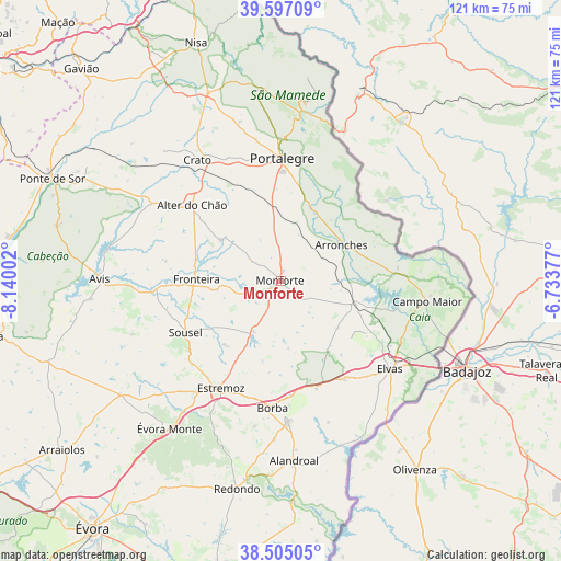
Monforte GPS coordinates[2]
39° 3' 11.448" North, 7° 26' 12.804" West
| Map corner | latitude | longitude |
|---|---|---|
| Upper-left | 39.59709°, | -8.14002° |
| Center: | 39.05318°, | -7.43689° |
| Lower-right: | 38.50505°, | -6.73377° |
| Map W x H: | 121.4×121.4 km | = 75.4×75.4mi |
| max Lat: | 42.11337° ⇑63.3% North |
| Monforte: | 39.05318° |
| min Lat: | ⇓36.7% South 32.6448° |
| min Long | Monforte | max Long |
| -31.17847° | -7.43689° | -6.27308° |
| W 94.2%⇐ | ⇒5.8% E |
Elevation
Elevation of Monforte is 285 m = 935 ft, and this is 108 m = 354 ft above average elevation for this country.
| Max E: |
1008 m = 3307 ft | 20.2% |
| Monforte | 285 m 935 ft | |
| Avg. | 177 m = 581 ft | |
Min E: |
-128 m = -420 ft | 79.8% |
See also: Portugal elevation on elevation.city.
Geographical zone
Monforte is located in North temperate zone (between Tropic of Cancer and the Arctic Circle). Distance of this Northern Tropic circle is 1736.4 km =1078.9 mi to South.| Distance of | km | miles | from Monforte |
|---|---|---|---|
| North Pole | 5664.8 | 3519.9 | to North |
| Arctic Circle | 3058.9 | 1900.7 | to North |
| Tropic Cancer | 1736.4 | 1078.9 | to South |
| Equator | 4342.3 | 2698.2 | to South |


Nearby cities:
15 places around Monforte: (largest is in red/bold)
• Alegrete
22.9 km =14.2 mi,  25°
25°
• Alter do Chão
25 km =15.5 mi,  309°
309°
• Arronches
15.1 km =9.4 mi,  59°
59°
• Borba
27.6 km =17.1 mi,  183°
183°
• Campo Maior
32.4 km =20.1 mi,  96°
96°
• Elvas
30.4 km =18.9 mi,  128°
128°
• Estremoz
26.6 km =16.5 mi,  209°
209°
• Fortios
30.7 km =19.1 mi,  349°
349°
• Fronteira
18.3 km =11.4 mi,  271°
271°
• Portalegre
26.8 km =16.7 mi,  1°
1°
• Reguengo
27.5 km =17.1 mi,  8°
8°
• São Julião
31.9 km =19.8 mi,  19°
19°
• Urra
19.8 km =12.3 mi, 9°
• Vale da Amoreira
22.7 km =14.1 mi, 274°
• Vila Viçosa
30.7 km =19.1 mi, 176°
Sources, notices
• [Note1] Compared only with cities in Portugal existing in our database
• [Src1] Map data: © OpenStreetMap contributors (CC-BY-SA)
• [Src2] Other city data from geonames.org with taken over terms of usage.
• [Src3] Geographical zone / Annual Mean Temperature by Robert A. Rohde @ Wikipedia
