Elvas geodata
Elvas (Portalegre) is a seat of a second-order administrative division; located in Portugal in Europe/Lisbon (GMT+1) time zone. With population of 9,904 people, there are 219 cities with bigger population in this country. Compared to other cities in Portugal, 66.5% of cities are located further ↑North; 97.7% of cities are located further ←West and 82.9% of cities have lower elevation than Elvas. Note1


Elvas GPS coordinates[2]
38° 52' 53.4" North, 7° 9' 46.152" West
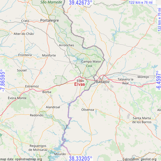
| Map corner | latitude | longitude |
|---|---|---|
| Upper-left | 39.42673°, | -7.86595° |
| Center: | 38.8815°, | -7.16282° |
| Lower-right: | 38.33205°, | -6.4597° |
| Map W x H: | 121.7×121.7 km | = 75.6×75.6mi |
| max Lat: | 42.11337° ⇑66.5% North |
| Elvas: | 38.8815° |
| min Lat: | ⇓33.5% South 32.6448° |
| min Long | Elvas | max Long |
| -31.17847° | -7.16282° | -6.27308° |
| W 97.7%⇐ | ⇒2.3% E |
Elevation
Elevation of Elvas is 326 m = 1070 ft, and this is 149 m = 489 ft above average elevation for this country.
| Max E: |
1008 m = 3307 ft | 17.1% |
| Elvas | 326 m 1070 ft | |
| Avg. | 177 m = 581 ft | |
Min E: |
-128 m = -420 ft | 82.9% |
See also: Portugal elevation on elevation.city.
Geographical zone
Elvas is located in North temperate zone (between Tropic of Cancer and the Arctic Circle). Distance of this Northern Tropic circle is 1717.3 km =1067.1 mi to South.| Distance of | km | miles | from Elvas |
|---|---|---|---|
| North Pole | 5683.8 | 3531.7 | to North |
| Arctic Circle | 3078 | 1912.6 | to North |
| Tropic Cancer | 1717.3 | 1067.1 | to South |
| Equator | 4323.2 | 2686.3 | to South |


Nearby cities:
15 places around Elvas: (largest is in red/bold)
• Alandroal
28.8 km =17.9 mi,  226°
226°
• Alegrete
42.2 km =26.2 mi,  340°
340°
• Arronches
28.8 km =17.9 mi, 338°
• Borba
26.6 km =16.5 mi,  251°
251°
• Campo Maior
17.4 km =10.8 mi,  29°
29°
• Estremoz
36.9 km =22.9 mi,  263°
263°
• Fronteira
46.3 km =28.8 mi,  294°
294°
• Monforte
30.4 km =18.9 mi,  308°
308°
• Portalegre
51.4 km =31.9 mi,  333°
333°
• Redondo
42.2 km =26.2 mi, 232°
• Reguengo
50.4 km =31.3 mi, 336°
• São Julião
50.7 km =31.5 mi,  345°
345°
• Urra
43.6 km =27.1 mi, 332°
• Vale da Amoreira
50.8 km =31.6 mi, 294°
• Vila Viçosa
24.9 km =15.5 mi,  242°
242°
Sources, notices
• [Note1] Compared only with cities in Portugal existing in our database
• [Src1] Map data: © OpenStreetMap contributors (CC-BY-SA)
• [Src2] Other city data from geonames.org with taken over terms of usage.
• [Src3] Geographical zone / Annual Mean Temperature by Robert A. Rohde @ Wikipedia
