Fuzeta geodata
Fuzeta (Faro) is a populated place; located in Portugal in Europe/Lisbon (GMT+1) time zone. With population of 2,146 people, there are 634 cities with bigger population in this country. Compared to other cities in Portugal, 95.7% of cities are located further ↑North; 86.7% of cities are located further ←West and 92.5% of cities have higher elevation than Fuzeta. Note1


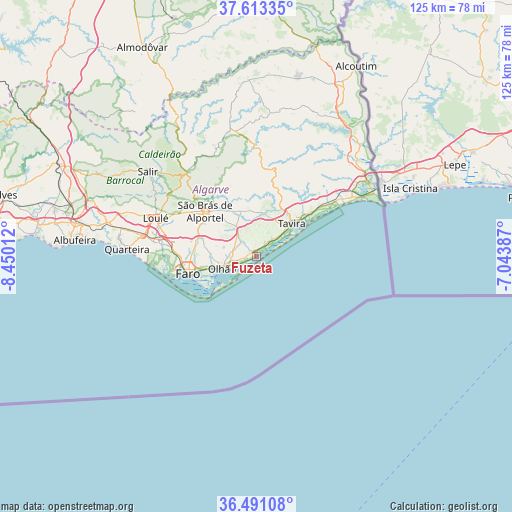
Fuzeta GPS coordinates[2]
37° 3' 15.444" North, 7° 44' 49.164" West
| Map corner | latitude | longitude |
|---|---|---|
| Upper-left | 37.61335°, | -8.45012° |
| Center: | 37.05429°, | -7.74699° |
| Lower-right: | 36.49108°, | -7.04387° |
| Map W x H: | 124.8×124.8 km | = 77.5×77.5mi |
| max Lat: | 42.11337° ⇑95.7% North |
| Fuzeta: | 37.05429° |
| min Lat: | ⇓4.3% South 32.6448° |
| min Long | Fuzeta | max Long |
| -31.17847° | -7.74699° | -6.27308° |
| W 86.7%⇐ | ⇒13.3% E |
Elevation
Elevation of Fuzeta is 13 m = 43 ft, and this is 164 m = 538 ft below average elevation for this country.
| Max E: |
1008 m = 3307 ft | 92.5% |
| Avg. | 177 m = 581 ft | |
| Fuzeta | 13 m = 43 ft | |
Min E: |
-128 m = -420 ft | 7.5% |
See also: Portugal elevation on elevation.city.
Geographical zone
Fuzeta is located in North temperate zone (between Tropic of Cancer and the Arctic Circle). Distance of this Northern Tropic circle is 1514.1 km =940.8 mi to South.| Distance of | km | miles | from Fuzeta |
|---|---|---|---|
| North Pole | 5887 | 3658 | to North |
| Arctic Circle | 3281.1 | 2038.8 | to North |
| Tropic Cancer | 1514.1 | 940.8 | to South |
| Equator | 4120.1 | 2560.1 | to South |


Nearby cities:
15 places around Fuzeta: (largest is in red/bold)
• Almancil
25.4 km =15.8 mi,  278°
278°
• Cabanas de Tavira
15.8 km =9.8 mi,  55°
55°
• Conceição
16.4 km =10.2 mi,  50°
50°
• Estói
13.8 km =8.6 mi,  289°
289°
• Faro
16.5 km =10.3 mi,  256°
256°
• Laranjeiro
5.6 km =3.5 mi, 285°
• Luz
5.7 km =3.5 mi,  41°
41°
• Manta Rota
23.9 km =14.9 mi, 57°
• Moncarapacho
4.9 km =3 mi,  312°
312°
• Olhão
8.8 km =5.5 mi,  251°
251°
• Santa Bárbara de Nexe
20.3 km =12.6 mi, 286°
• Santa Luzia
9.2 km =5.7 mi, 54°
• São Brás de Alportel
16.6 km =10.3 mi, 311°
• Tavira
11.9 km =7.4 mi, 47°
• Vila Nova De Cacela
23.3 km =14.5 mi, 55°
Sources, notices
• [Note1] Compared only with cities in Portugal existing in our database
• [Src1] Map data: © OpenStreetMap contributors (CC-BY-SA)
• [Src2] Other city data from geonames.org with taken over terms of usage.
• [Src3] Geographical zone / Annual Mean Temperature by Robert A. Rohde @ Wikipedia
