São Brás de Alportel geodata
São Brás de Alportel (Faro) is a seat of a second-order administrative division; located in Portugal in Europe/Lisbon (GMT+1) time zone. With population of 11,153 people, there are 191 cities with bigger population in this country. Compared to other cities in Portugal, 91.9% of cities are located further ↑North; 83% of cities are located further ←West and 77.1% of cities have lower elevation than São Brás de Alportel. Note1
Administrative division(s):
- Level 1: Faro
- Level 2: São Brás de Alportel
- Level 3: São Brás de Alportel


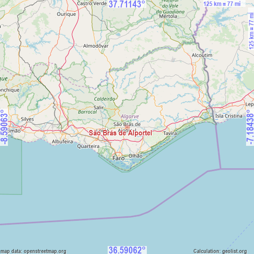
São Brás de Alportel GPS coordinates[2]
37° 9' 11.16" North, 7° 53' 15.036" West
| Map corner | latitude | longitude |
|---|---|---|
| Upper-left | 37.71143°, | -8.59063° |
| Center: | 37.1531°, | -7.88751° |
| Lower-right: | 36.59062°, | -7.18438° |
| Map W x H: | 124.6×124.6 km | = 77.4×77.4mi |
| max Lat: | 42.11337° ⇑91.9% North |
| São Brás de Alportel: | 37.1531° |
| min Lat: | ⇓8.1% South 32.6448° |
| min Long | São Brás de A | max Long |
| -31.17847° | -7.88751° | -6.27308° |
| W 83%⇐ | ⇒17% E |
Elevation
Elevation of São Brás de Alportel is 254 m = 833 ft, and this is 77 m = 253 ft above average elevation for this country.
| Max E: |
1008 m = 3307 ft | 22.9% |
| São Brás de Alportel | 254 m 833 ft | |
| Avg. | 177 m = 581 ft | |
Min E: |
-128 m = -420 ft | 77.1% |
See also: Portugal elevation on elevation.city.
Geographical zone
São Brás de Alportel is located in North temperate zone (between Tropic of Cancer and the Arctic Circle). Distance of this Northern Tropic circle is 1525.1 km =947.7 mi to South.| Distance of | km | miles | from São Brás de Alportel |
|---|---|---|---|
| North Pole | 5876 | 3651.2 | to North |
| Arctic Circle | 3270.1 | 2031.9 | to North |
| Tropic Cancer | 1525.1 | 947.7 | to South |
| Equator | 4131 | 2566.9 | to South |


Nearby cities:
15 places around São Brás de Alportel: (largest is in red/bold)
• Almancil
14.7 km =9.1 mi,  239°
239°
• Boliqueime
24.1 km =15 mi,  265°
265°
• Estói
6.5 km =4 mi,  185°
185°
• Faro
15.4 km =9.6 mi, 193°
• Fuzeta
16.6 km =10.3 mi,  131°
131°
• Laranjeiro
11.8 km =7.3 mi,  143°
143°
• Loulé
11.8 km =7.3 mi,  261°
261°
• Luz
17.6 km =10.9 mi,  112°
112°
• Moncarapacho
11.8 km =7.3 mi, 131°
• Olhão
14.4 km =8.9 mi,  163°
163°
• Quarteira
21.1 km =13.1 mi, 243°
• Santa Bárbara de Nexe
8.7 km =5.4 mi,  233°
233°
• Santa Luzia
20.8 km =12.9 mi, 105°
• Tavira
21.4 km =13.3 mi,  97°
97°
• Vilamoura
21.6 km =13.4 mi,  250°
250°
Sources, notices
• [Note1] Compared only with cities in Portugal existing in our database
• [Src1] Map data: © OpenStreetMap contributors (CC-BY-SA)
• [Src2] Other city data from geonames.org with taken over terms of usage.
• [Src3] Geographical zone / Annual Mean Temperature by Robert A. Rohde @ Wikipedia
