Belas geodata
Belas (Lisbon) is a populated place; located in Portugal in Europe/Lisbon (GMT+1) time zone. With population of 21,019 people, there are 88 cities with bigger population in this country. Compared to other cities in Portugal, 70.5% of cities are located further ↑North; 85% of cities are located further →East and 67% of cities have lower elevation than Belas. Note1


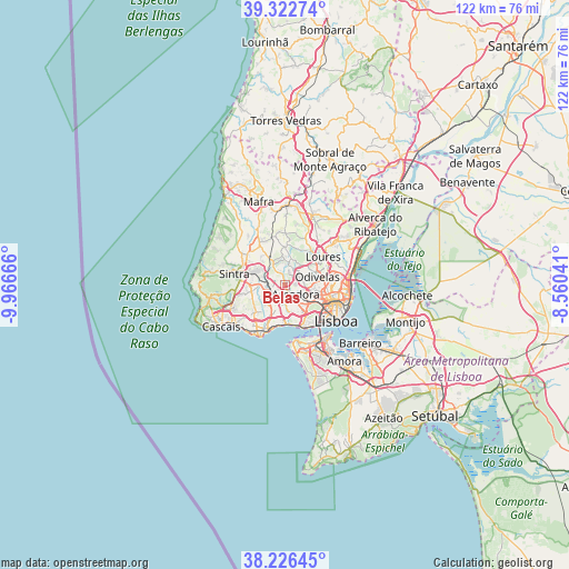
Belas GPS coordinates[2]
38° 46' 36.12" North, 9° 15' 48.708" West
| Map corner | latitude | longitude |
|---|---|---|
| Upper-left | 39.32274°, | -9.96666° |
| Center: | 38.7767°, | -9.26353° |
| Lower-right: | 38.22645°, | -8.56041° |
| Map W x H: | 121.9×121.9 km | = 75.7×75.7mi |
| max Lat: | 42.11337° ⇑70.5% North |
| Belas: | 38.7767° |
| min Lat: | ⇓29.5% South 32.6448° |
| min Long | Belas | max Long |
| -31.17847° | -9.26353° | -6.27308° |
| W 15%⇐ | ⇒85% E |
Elevation
Elevation of Belas is 186 m = 610 ft, and this is 9 m = 30 ft above average elevation for this country.
| Max E: |
1008 m = 3307 ft | 33% |
| Belas | 186 m 610 ft | |
| Avg. | 177 m = 581 ft | |
Min E: |
-128 m = -420 ft | 67% |
See also: Portugal elevation on elevation.city.
Geographical zone
Belas is located in North temperate zone (between Tropic of Cancer and the Arctic Circle). Distance of this Northern Tropic circle is 1705.6 km =1059.8 mi to South.| Distance of | km | miles | from Belas |
|---|---|---|---|
| North Pole | 5695.5 | 3539 | to North |
| Arctic Circle | 3089.6 | 1919.8 | to North |
| Tropic Cancer | 1705.6 | 1059.8 | to South |
| Equator | 4311.6 | 2679.1 | to South |


Nearby cities:
15 places around Belas: (largest is in red/bold)
• Alfragide
6.3 km =3.9 mi,  142°
142°
• Amadora
3.8 km =2.4 mi,  131°
131°
• Barcarena
5.1 km =3.2 mi,  196°
196°
• Benfica
6 km =3.7 mi,  118°
118°
• Cacém
3.2 km =2 mi,  250°
250°
• Caneças
5.2 km =3.2 mi,  38°
38°
• Carnaxide
5.7 km =3.5 mi,  165°
165°
• Famões
4.8 km =3 mi,  74°
74°
• Massamá
3.1 km =1.9 mi,  209°
209°
• Odivelas
7.1 km =4.4 mi,  75°
75°
• Pontinha
5.7 km =3.5 mi,  100°
100°
• Porto Salvo
7 km =4.3 mi, 210°
• Queijas
6.4 km =4 mi,  179°
179°
• Queluz
2.4 km =1.5 mi,  160°
160°
• Rio de Mouro
5.7 km =3.5 mi,  258°
258°
Sources, notices
• [Note1] Compared only with cities in Portugal existing in our database
• [Src1] Map data: © OpenStreetMap contributors (CC-BY-SA)
• [Src2] Other city data from geonames.org with taken over terms of usage.
• [Src3] Geographical zone / Annual Mean Temperature by Robert A. Rohde @ Wikipedia
