Caneças geodata
Caneças (Lisbon) is a populated place; located in Portugal in Europe/Lisbon (GMT+1) time zone. With population of 10,978 people, there are 197 cities with bigger population in this country. Compared to other cities in Portugal, 68.3% of cities are located further ↑North; 83.5% of cities are located further →East and 74.7% of cities have lower elevation than Caneças. Note1


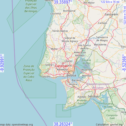
Caneças GPS coordinates[2]
38° 48' 47.556" North, 9° 13' 36.444" West
| Map corner | latitude | longitude |
|---|---|---|
| Upper-left | 39.35897°, | -9.92991° |
| Center: | 38.81321°, | -9.22679° |
| Lower-right: | 38.26324°, | -8.52366° |
| Map W x H: | 121.8×121.8 km | = 75.7×75.7mi |
| max Lat: | 42.11337° ⇑68.3% North |
| Caneças: | 38.81321° |
| min Lat: | ⇓31.7% South 32.6448° |
| min Long | Caneças | max Long |
| -31.17847° | -9.22679° | -6.27308° |
| W 16.5%⇐ | ⇒83.5% E |
Elevation
Elevation of Caneças is 234 m = 768 ft, and this is 57 m = 187 ft above average elevation for this country.
| Max E: |
1008 m = 3307 ft | 25.3% |
| Caneças | 234 m 768 ft | |
| Avg. | 177 m = 581 ft | |
Min E: |
-128 m = -420 ft | 74.7% |
See also: Portugal elevation on elevation.city.
Geographical zone
Caneças is located in North temperate zone (between Tropic of Cancer and the Arctic Circle). Distance of this Northern Tropic circle is 1709.7 km =1062.4 mi to South.| Distance of | km | miles | from Caneças |
|---|---|---|---|
| North Pole | 5691.4 | 3536.5 | to North |
| Arctic Circle | 3085.5 | 1917.2 | to North |
| Tropic Cancer | 1709.7 | 1062.4 | to South |
| Equator | 4315.6 | 2681.6 | to South |


Nearby cities:
15 places around Caneças: (largest is in red/bold)
• Almargem
5.3 km =3.3 mi,  311°
311°
• Amadora
6.6 km =4.1 mi,  183°
183°
• Apelação
8.2 km =5.1 mi,  89°
89°
• Belas
5.2 km =3.2 mi,  218°
218°
• Benfica
7.2 km =4.5 mi,  163°
163°
• Cacém
8 km =5 mi,  230°
230°
• Charneca
7.9 km =4.9 mi,  114°
114°
• Famões
3.1 km =1.9 mi,  152°
152°
• Loures
5.4 km =3.4 mi,  68°
68°
• Odivelas
4.4 km =2.7 mi,  121°
121°
• Olival do Basto
5.8 km =3.6 mi, 115°
• Pontinha
5.6 km =3.5 mi, 154°
• Póvoa de Santo Adrião
5.4 km =3.4 mi, 105°
• Queluz
6.7 km =4.2 mi,  200°
200°
• Ramada
3.5 km =2.2 mi, 107°
Sources, notices
• [Note1] Compared only with cities in Portugal existing in our database
• [Src1] Map data: © OpenStreetMap contributors (CC-BY-SA)
• [Src2] Other city data from geonames.org with taken over terms of usage.
• [Src3] Geographical zone / Annual Mean Temperature by Robert A. Rohde @ Wikipedia
