Amor geodata
Amor (Leiria) is a populated place; located in Portugal in Europe/Lisbon (GMT+1) time zone. With population of 4,870 people, there are 440 cities with bigger population in this country. Compared to other cities in Portugal, 51.6% of cities are located further ↓South; 70.2% of cities are located further →East and 84% of cities have higher elevation than Amor. Note1


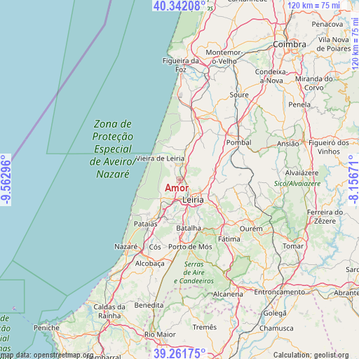
Amor GPS coordinates[2]
39° 48' 14.544" North, 8° 51' 35.424" West
| Map corner | latitude | longitude |
|---|---|---|
| Upper-left | 40.34208°, | -9.56296° |
| Center: | 39.80404°, | -8.85984° |
| Lower-right: | 39.26175°, | -8.15671° |
| Map W x H: | 120.1×120.1 km | = 74.6×74.6mi |
| max Lat: | 42.11337° ⇑48.4% North |
| Amor: | 39.80404° |
| min Lat: | ⇓51.6% South 32.6448° |
| min Long | Amor | max Long |
| -31.17847° | -8.85984° | -6.27308° |
| W 29.8%⇐ | ⇒70.2% E |
Elevation
Elevation of Amor is 25 m = 82 ft, and this is 152 m = 499 ft below average elevation for this country.
| Max E: |
1008 m = 3307 ft | 84% |
| Avg. | 177 m = 581 ft | |
| Amor | 25 m = 82 ft | |
Min E: |
-128 m = -420 ft | 16% |
See also: Portugal elevation on elevation.city.
Geographical zone
Amor is located in North temperate zone (between Tropic of Cancer and the Arctic Circle). Distance of this Northern Tropic circle is 1819.9 km =1130.8 mi to South.| Distance of | km | miles | from Amor |
|---|---|---|---|
| North Pole | 5581.3 | 3468.1 | to North |
| Arctic Circle | 2975.4 | 1848.8 | to North |
| Tropic Cancer | 1819.9 | 1130.8 | to South |
| Equator | 4425.8 | 2750.1 | to South |


Nearby cities:
15 places around Amor: (largest is in red/bold)
• Batalha
16.3 km =10.1 mi,  169°
169°
• Caranguejeira
14.5 km =9 mi,  116°
116°
• Fátima
27 km =16.8 mi,  138°
138°
• Leiria
8.1 km =5 mi,  146°
146°
• Louriçal
24.6 km =15.3 mi,  25°
25°
• Maceira
13.2 km =8.2 mi,  192°
192°
• Marinha Grande
8.8 km =5.5 mi,  224°
224°
• Monte Real
5.4 km =3.4 mi,  356°
356°
• Monte Redondo
10.9 km =6.8 mi,  12°
12°
• Pataias
18.9 km =11.7 mi, 217°
• Pombal
23.4 km =14.5 mi,  57°
57°
• Porto de Mós
22.8 km =14.2 mi, 171°
• Santa Catarina da Serra
20.3 km =12.6 mi,  133°
133°
• Souto da Carpalhosa
5.4 km =3.4 mi,  23°
23°
• Vieira de Leiria
9.6 km =6 mi,  319°
319°
Sources, notices
• [Note1] Compared only with cities in Portugal existing in our database
• [Src1] Map data: © OpenStreetMap contributors (CC-BY-SA)
• [Src2] Other city data from geonames.org with taken over terms of usage.
• [Src3] Geographical zone / Annual Mean Temperature by Robert A. Rohde @ Wikipedia
