Negrelos geodata
Negrelos (Porto) is a populated place; located in Portugal in Europe/Lisbon (GMT+1) time zone. With population of 6,664 people, there are 332 cities with bigger population in this country. Compared to other cities in Portugal, 85.1% of cities are located further ↓South; 62.8% of cities are located further ←West and 61.5% of cities have lower elevation than Negrelos. Note1


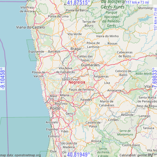
Negrelos GPS coordinates[2]
41° 20' 58.056" North, 8° 24' 5.22" West
| Map corner | latitude | longitude |
|---|---|---|
| Upper-left | 41.87515°, | -9.10458° |
| Center: | 41.34946°, | -8.40145° |
| Lower-right: | 40.81949°, | -7.69833° |
| Map W x H: | 117.4×117.4 km | = 72.9×72.9mi |
| max Lat: | 42.11337° ⇑14.9% North |
| Negrelos: | 41.34946° |
| min Lat: | ⇓85.1% South 32.6448° |
| min Long | Negrelos | max Long |
| -31.17847° | -8.40145° | -6.27308° |
| W 62.8%⇐ | ⇒37.2% E |
Elevation
Elevation of Negrelos is 164 m = 538 ft, and this is 13 m = 43 ft below average elevation for this country.
| Max E: |
1008 m = 3307 ft | 38.5% |
| Avg. | 177 m = 581 ft | |
| Negrelos | 164 m = 538 ft | |
Min E: |
-128 m = -420 ft | 61.5% |
See also: Portugal elevation on elevation.city.
Geographical zone
Negrelos is located in North temperate zone (between Tropic of Cancer and the Arctic Circle). Distance of this Northern Tropic circle is 1991.7 km =1237.6 mi to South.| Distance of | km | miles | from Negrelos |
|---|---|---|---|
| North Pole | 5409.4 | 3361.2 | to North |
| Arctic Circle | 2803.5 | 1742 | to North |
| Tropic Cancer | 1991.7 | 1237.6 | to South |
| Equator | 4597.6 | 2856.8 | to South |


Nearby cities:
15 places around Negrelos: (largest is in red/bold)
• Aves
2.4 km =1.5 mi,  342°
342°
• Barrosas
8.5 km =5.3 mi,  85°
85°
• Caldas de Vizela
8.5 km =5.3 mi,  64°
64°
• Carvalhosa
6.4 km =4 mi,  148°
148°
• Freamunde
8.8 km =5.5 mi,  140°
140°
• Lordelo
3.3 km =2.1 mi,  32°
32°
• Lustosa
7.1 km =4.4 mi,  97°
97°
• Moreira de Conegos
6.6 km =4.1 mi,  51°
51°
• Paços de Ferreira
8.4 km =5.2 mi,  165°
165°
• Rebordões
1.9 km =1.2 mi,  288°
288°
• Riba de Ave
5.4 km =3.4 mi,  13°
13°
• Santo Tirso
6.4 km =4 mi,  263°
263°
• Serzedelo
6.4 km =4 mi, 25°
• São Miguel do Couto
5.4 km =3.4 mi,  248°
248°
• Vilarinho
6 km =3.7 mi,  79°
79°
Sources, notices
• [Note1] Compared only with cities in Portugal existing in our database
• [Src1] Map data: © OpenStreetMap contributors (CC-BY-SA)
• [Src2] Other city data from geonames.org with taken over terms of usage.
• [Src3] Geographical zone / Annual Mean Temperature by Robert A. Rohde @ Wikipedia
